Our mission is to help computational modelers develop, document, and share their computational models in accordance with community standards and good open science and software engineering practices. Model authors can publish their model source code in the Computational Model Library with narrative documentation as well as metadata that supports open science and emerging norms that facilitate software citation, computational reproducibility / frictionless reuse, and interoperability. Model authors can also request private peer review of their computational models. Models that pass peer review receive a DOI once published.
All users of models published in the library must cite model authors when they use and benefit from their code.
Please check out our model publishing tutorial and feel free to contact us if you have any questions or concerns about publishing your model(s) in the Computational Model Library.
Displaying 10 of 335 results for "Michael D. Slater" clear search
STiMUS-HAI: A Stigmergic–Mutualistic Agent-Based Model of Human-AI Collaboration on Shared Digital Artefacts
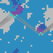
Yevgeny Patarakin | Published Monday, July 13, 2026STiMUS-HAI (Stigmergic–Mutualistic IMOI Model, Human-AI extension) is an agent-based model of teamwork in socio-technical systems where human and AI contributors collaborate through shared digital artefacts — wiki pages, code files, issue tickets, project cards, Scratch projects — represented as patches in a NetLogo world. It extends the human-only base model STiMUS v2.2, which established that two coordination mechanisms — stigmergy (indirect coordination through traces left in the environment) and mutualism (mutual benefit between contributors and the artefacts they tend) — can be decoupled: stigmergy decides where a contributor works, mutualism decides with what effort. STiMUS-HAI preserves this decoupling unchanged and adds two further theoretical questions: whether mixing AI agents into a human team distorts human coordination in ways that aggregate indicators hide, and whether AI’s cost to team outcomes depends on the type of work AI performs, not only on how much of it is present.
Two breeds of turtle — humans and ai-agents — follow identical target-selection, pheromone, and mutualism rules, so that any behavioural difference is attributable to team composition rather than a built-in advantage. The one designed asymmetry: AI agents never accumulate shared-mental-model and their motivation is fixed rather than adaptive. On top of this v3.0 baseline, v3.1 adds a task-type dimension to artefacts (“prediction” versus “judgment”, set via a judgment-share slider) that scales down AI edit-power specifically on judgment-requiring artefacts, and an ai-trust mechanic: humans build or lose trust in AI contributions based on the population-relative percentile rank of observed AI work quality (bottom-quartile work counts as an observed “error”), and that trust gates how much mutualistic benefit a human derives from continuing an AI’s work. Trust erodes quickly on a single error and recovers only after a streak of confirmed successes — an intentional asymmetry.
Interplay between stakeholders of the management of a river
Christophe Sibertin-Blanc Pascal Roggero Bertrand Baldet | Published Wednesday, November 12, 2014This model describes and analyses the outcomes of the confrontation of interests, some conflicting, some common, about the management of a small river in SW France
Peer reviewed CHIME ABM Hurricane Evacuation Model
Joshua Watts | Published Friday, March 03, 2017 | Last modified Wednesday, May 29, 2019The CHIME ABM explores information distribution networks and agents’ protective decision making in the context of hurricane landfall.
The emergence of tag-mediated altruism in structured societies
Shade Shutters David Hales | Published Tuesday, January 20, 2015 | Last modified Thursday, March 02, 2023This abstract model explores the emergence of altruistic behavior in networked societies. The model allows users to experiment with a number of population-level parameters to better understand what conditions contribute to the emergence of altruism.
The PARSO_demo Model
Davide Secchi | Published Tuesday, November 05, 2019This model explores different aspects of the formation of urban neighbourhoods where residents believe in values distant from those dominant in society. Or, at least, this is what the Danish government beliefs when they discuss their politics about parallel societies. This simulation is set to understand (a) whether these alternative values areas form and what determines their formation, (b) if they are linked to low or no income residents, and (c) what happens if they disappear from the map. All these three points are part of the Danish government policy. This agent-based model is set to understand the boundaries and effects of this policy.
City Sandbox
Javier Sandoval | Published Thursday, January 09, 2020This model grows land use patterns that emerge as a result of land-use compatibilities stablished in urban development plans, land topography, and street networks. It contains urban brushes to paint streets and land uses as a way to learn about urban pattern emergence through free experimentation.
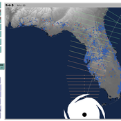
Peer reviewed CHIME ABM of Hurricane Evacuation
C Michael Barton Sean Bergin Joshua Watts Joshua Alland Rebecca Morss | Published Monday, October 18, 2021 | Last modified Tuesday, January 04, 2022The Communicating Hazard Information in the Modern Environment (CHIME) agent-based model (ABM) is a Netlogo program that facilitates the analysis of information flow and protective decisions across space and time during hazardous weather events. CHIME ABM provides a platform for testing hypotheses about collective human responses to weather forecasts and information flow, using empirical data from historical hurricanes. The model uses real world geographical and hurricane data to set the boundaries of the simulation, and it uses historical hurricane forecast information from the National Hurricane Center to initiate forecast information flow to citizen agents in the model.
Peer reviewed The Indus Village's Weather model: procedural generation of daily weather
Andreas Angourakis | Published Tuesday, May 13, 2025Overview
The Weather model is a procedural generation model designed to create realistic daily weather data for socioecological simulations. It generates synthetic weather time series for solar radiation, temperature, and precipitation using algorithms based on sinusoidal and double logistic functions. The model incorporates stochastic variation to mimic unpredictable weather patterns and aims to provide realistic yet flexible weather inputs for exploring diverse climate scenarios.
The Weather model can be used independently or integrated into larger models, providing realistic weather patterns without extensive coding or data collection. It can be customized to meet specific requirements, enabling users to gain a better understanding of the underlying mechanisms and have greater confidence in their applications.
…
Peer reviewed COMOKIT
Patrick Taillandier Alexis Drogoul Benoit Gaudou Kevin Chapuis Nghi Huyng Quang Doanh Nguyen Ngoc Arthur Brugière Pierre Larmande Marc Choisy Damien Philippon | Published Tuesday, May 26, 2020 | Last modified Wednesday, July 01, 2020In the face of the COVID-19 pandemic, public health authorities around the world have experimented, in a short period of time, with various combinations of interventions at different scales. However, as the pandemic continues to progress, there is a growing need for tools and methodologies to quickly analyze the impact of these interventions and answer concrete questions regarding their effectiveness, range and temporality.
COMOKIT, the COVID-19 modeling kit, is such a tool. It is a computer model that allows intervention strategies to be explored in silico before their possible implementation phase. It can take into account important dimensions of policy actions, such as the heterogeneity of individual responses or the spatial aspect of containment strategies.
In COMOKIT, built using the agent-based modeling and simulation platform GAMA, the profiles, activities and interactions of people, person-to-person and environmental transmissions, individual clinical statuses, public health policies and interventions are explicitly represented and they all serve as a basis for describing the dynamics of the epidemic in a detailed and realistic representation of space.
…
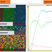
The simulation on the study of the optimal business strategy with the interaction between technologies and consumers.
sej-yoo | Published Monday, June 27, 2022 | Last modified Monday, July 04, 2022HOW IT WORKS
This model consists of three agents, and each agent type operates per business theories as below.
a. New technologies(Tech): It evolves per sustaining or disruptive technology trajectory with the constraint of project management triangle (Scope, Time, Quality, and Cost).
b. Entrepreneurs(Entre): It builds up the solution by combining Tech components per its own strategy (Exploration, Exploitation, or Ambidex).
c. Consumer(Consumer): It selects the solution per its own preference due to Diffusion of innovation theory (Innovators, Early Adopters, Early Majority, Late Majority, Laggards)
…
Displaying 10 of 335 results for "Michael D. Slater" clear search