About the CoMSES Model Library more info
Our mission is to help computational modelers at all levels engage in the establishment and adoption of community standards and good practices for developing and sharing computational models. Model authors can freely publish their model source code in the Computational Model Library alongside narrative documentation, open science metadata, and other emerging open science norms that facilitate software citation, reproducibility, interoperability, and reuse. Model authors can also request peer review of their computational models to receive a DOI.
All users of models published in the library must cite model authors when they use and benefit from their code.
Please check out our model publishing tutorial and contact us if you have any questions or concerns about publishing your model(s) in the Computational Model Library.
We also maintain a curated database of over 7500 publications of agent-based and individual based models with additional detailed metadata on availability of code and bibliometric information on the landscape of ABM/IBM publications that we welcome you to explore.
Displaying 10 of 16 results vegetation clear
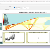
Sandy Beach Visitor Flow: An Agent-Based Model
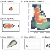
Elham Bakhshianlamouki | Published Thursday, March 14, 2024The model is intended to simulate visitor spatial and temporal dynamics, encompassing their numbers, activities, and distribution along a coastline influenced by beach landscape design. Our primary focus is understanding how the spatial distribution of services and recreational facilities (e.g., beach width, entrance location, recreational facilities, parking availability) impacts visitation density. Our focus is not on tracking the precise visitation density but rather on estimating the areas most affected by visitor activity. This comprehension allows for assessing the diverse influences of beach layouts on spatial visitor density and, consequently, on the landscape’s biophysical characteristics (e.g., vegetation, fauna, and sediment features).
Peer reviewed HUMLAND: HUMan impact on LANDscapes agent-based model
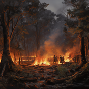
Anastasia Nikulina Katharine MacDonald Anhelina Zapolska Maria Antonia Serge Marco Davoli Dave van Wees Fulco Scherjon | Published Monday, October 16, 2023The HUMan impact on LANDscapes (HUMLAND) model has been developed to track and quantify the intensity of different impacts on landscapes at the continental level. This agent-based model focuses on determining the most influential factors in the transformation of interglacial vegetation with a specific emphasis on burning organized by hunter-gatherers. HUMLAND integrates various spatial datasets as input and target for the agent-based model results. Additionally, the simulation incorporates recently obtained continental-scale estimations of fire return intervals and the speed of vegetation regrowth. The obtained results include maps of possible scenarios of modified landscapes in the past and quantification of the impact of each agent, including climate, humans, megafauna, and natural fires.
Peer reviewed Yards
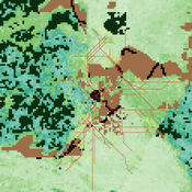
Emily Minor Soraida Garcia srailsback Philip Johnson | Published Thursday, November 02, 2023This is a model of plant communities in urban and suburban residential neighborhoods. These plant communities are of interest because they provide many benefits to human residents and also provide habitat for wildlife such as birds and pollinators. The model was designed to explore the social factors that create spatial patterns in biodiversity in yards and gardens. In particular, the model was originally developed to determine whether mimicry behaviors–-or neighbors copying each other’s yard design–-could produce observed spatial patterns in vegetation. Plant nurseries and socio-economic constraints were also added to the model as other potential sources of spatial patterns in plant communities.
The idea for the model was inspired by empirical patterns of spatial autocorrelation that have been observed in yard vegetation in Chicago, Illinois (USA), and other cities, where yards that are closer together are more similar than yards that are farther apart. The idea is further supported by literature that shows that people want their yards to fit into their neighborhood. Currently, the yard attribute of interest is the number of plant species, or species richness. Residents compare the richness of their yards to the richness of their neighbors’ yards. If a resident’s yard is too different from their neighbors, the resident will be unhappy and change their yard to make it more similar.
The model outputs information about the diversity and identity of plant species in each yard. This can be analyzed to look for spatial autocorrelation patterns in yard diversity and to explore relationships between mimicry behaviors, yard diversity, and larger scale diversity.
Exploring Pesticide use and Inter-row management in European Vineyards and their potential Impacts (EPIEVI)
Yang Chen Nina Schwarz | Published Tuesday, January 24, 2023The purpose of this study is to explore the potential impacts of pesticide use and inter-row management of European winegrowers in response to policy designs and climate change. Pesticides considered in this study include insecticides, pheromone dispensers (as an alternative to insecticides), fungicides (both the synthetic type and copper-sulphur based). Inter-row management concerns the arrangement of vegetation in the inter-rows and the type of vegetation.
RaMDry - Rangeland Model in Drylands
Pascal Fust Eva Schlecht | Published Friday, January 05, 2018 | Last modified Friday, April 01, 2022RaMDry allows to study the dynamic use of forage ressources by herbivores in semi-arid savanna with an emphasis on effects of change of climate and management. Seasonal dynamics affects the amount and the nutritional values of the available forage.
The role of dispersal, selection intensity, and extirpation risk in resilience to climate change: a trait-based modeling approach
Jessica Mo P. David Polly | Published Monday, February 07, 2022This NetLogo model simulates trait-based biotic responses to climate change in an environmentally heterogeneous continent in an evolving clade, the species of which are each represented by local populations that disperse and interbreed; they also are subject to selection, genetic drift, and local extirpation. We simulated mammalian herbivores, whose success depends on tooth crown height, vegetation type, precipitation and grit. This model investigates the role of dispersal, selection, extirpation, and other factors contribute to resilience under three climate change scenarios.
The Agent-Based Wildfire Simulation Environment (ABWiSE) translates the concept of a moving fire front as a set of mobile fire agents that respond to, and interact with, vegetation, wind, and terrain. Presently, the purpose of ABWiSE is to explore how ABM, using simple interactions between agents and a simple atmospheric feedback model, can simulate emergent fire spread patterns.
RAGE RAngeland Grazing Model
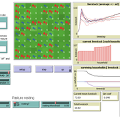
Gunnar Dressler Jürgen Groeneveld Carsten M Buchmann Cheng Guo Niklas Hase Jule Thober Karin Frank Birgit Müller | Published Monday, July 17, 2017 | Last modified Friday, October 26, 2018RAGE models a stylized common property grazing system. Agents follow a certain behavioral type. The model allows analyzing how household behavior with respect to a social norm on pasture resting affects long-term social-ecological system dynamics.
MedLanD Modeling Laboratory
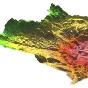
C Michael Barton Isaac Ullah Gary Mayer Sean Bergin Hessam Sarjoughian Helena Mitasova | Published Friday, May 08, 2015 | Last modified Thursday, December 14, 2017The MML is a hybrid modeling environment that couples an agent-based model of small-holder agropastoral households and a cellular landscape evolution model that simulates changes in erosion/deposition, soils, and vegetation.
MoPAgrIB: simulating savannah landscape mosaic under shifting cultivation
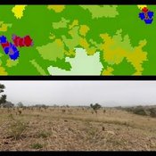
Nicolas Becu Marc Deconchat Eric Garine Kouami Kokou Christine Raimond | Published Monday, May 27, 2013 | Last modified Tuesday, January 21, 2014MoPAgrIB model simulates the movement of cultivated patches in a savannah vegetation mosaic ; how they move and relocate through the landscape, depending on farming practices, population growth, social rules and vegetation growth.
Displaying 10 of 16 results vegetation clear