Our mission is to help computational modelers develop, document, and share their computational models in accordance with community standards and good open science and software engineering practices. Model authors can publish their model source code in the Computational Model Library with narrative documentation as well as metadata that supports open science and emerging norms that facilitate software citation, computational reproducibility / frictionless reuse, and interoperability. Model authors can also request private peer review of their computational models. Models that pass peer review receive a DOI once published.
All users of models published in the library must cite model authors when they use and benefit from their code.
Please check out our model publishing tutorial and feel free to contact us if you have any questions or concerns about publishing your model(s) in the Computational Model Library.
Displaying 10 of 205 results for "Nuno R Barros De Oliveira" clear search
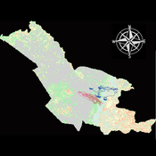
Agent modeling (ABM) as a tool to improve the mobility of “avoidant” birds in an ecological corridor in the localities of Chapinero, Teusaquillo, Barrios Unidos and Engativá of Bogotá city [Scenario 2]
Paula Alejandra Meza | Published Thursday, June 25, 2026Considering that two of the three avoider species could not reach the target area in the inittial scenario, five alternative corridor scenarios were created. In all cases, we generated a greater amount of cover area under ‘Urban forest’, including elements such as scattered trees, woody plants, wooded areas, and rows of trees. This covered type was selected since all three species use it as a regular habitat. That is the second sceneario where those ecological parks and other areas inside the capital city were boostered into “urban forest patches” or buffer points, with the idea of improving the survive of the three bird species and their movement. However one of the most restrictive specie was still having movement and survival issues.
Replicating the Macy & Sato Model: Trust, Cooperation and Market Formation in the U.S. and Japan
Oliver Will | Published Saturday, August 29, 2009 | Last modified Saturday, April 27, 2013A replication of the model “Trust, Cooperation and Market Formation in the U.S. and Japan” by Michael W. Macy and Yoshimichi Sato.
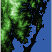
Shellmound Mobility
Henrique de Sena Kozlowski | Published Saturday, June 15, 2024Least Cost Path (LCP) analysis is a recurrent theme in spatial archaeology. Based on a cost of movement image, the user can interpret how difficult it is to travel around in a landscape. This kind of analysis frequently uses GIS tools to assess different landscapes. This model incorporates some aspects of the LCP analysis based on GIS with the capabilities of agent-based modeling, such as the possibility to simulate random behavior when moving. In this model the agent will travel around the coastal landscape of Southern Brazil, assessing its path based on the different cost of travel through the patches. The agents represent shellmound builders (sambaquieiros), who will travel mainly through the use of canoes around the lagoons.
How it works?
When the simulation starts the hiker agent moves around the world, a representation of the lagoon landscape of the Santa Catarina state in Southern Brazil. The agent movement is based on the travel cost of each patch. This travel cost is taken from a cost surface raster created in ArcMap to represent the different cost of movement around the landscape. Each tick the agent will have a chance to select the best possible patch to move in its Field of View (FOV) that will take it towards its target destination. If it doesn’t select the best possible patch, it will randomly choose one of the patches to move in its FOV. The simulation stops when the hiker agent reaches the target destination. The elevation raster file and the cost surface map are based on a 1 Arc-second (30m) resolution SRTM image, scaled down 5 times. Each patch represents a square of 150m, with an area of 0,0225km². The dataset uses a UTM Sirgas 2000 22S projection system. There are four different cost functions available to use. They change the cost surface used by the hikers to navigate around the world.
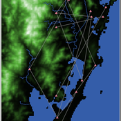
Shellmound Trade
Henrique de Sena Kozlowski | Published Saturday, June 15, 2024This model simulates different trade dynamics in shellmound (sambaqui) builder communities in coastal Southern Brazil. It features two simulation scenarios, one in which every site is the same and another one testing different rates of cooperation. The purpose of the model is to analyze the networks created by the trade dynamics and explore the different ways in which sambaqui communities were articulated in the past.
How it Works?
There are a few rules operating in this model. In either mode of simulation, each tick the agents will produce an amount of resources based on the suitability of the patches inside their occupation-radius, after that the procedures depend on the trade dynamic selected. For BRN? the agents will then repay their owed resources, update their reputation value and then trade again if they need to. For GRN? the agents will just trade with a connected agent if they need to. After that the agents will then consume a random amount of resources that they own and based on that they will grow (split) into a new site or be removed from the simulation. The simulation runs for 1000 ticks. Each patch correspond to a 300x300m square of land in the southern coast of Santa Catarina State in Brazil. Each agent represents a shellmound (sambaqui) builder community. The data for the world were made from a SRTM raster image (1 arc-second) in ArcMap. The sites can be exported into a shapefile (.shp) vector to display in ArcMap. It uses a UTM Sirgas 2000 22S projection system.
Anthill: A harvester ant colony built from the published science
Adrian Diez Cuadrado | Published Thursday, September 17, 2026 | Last modified Thursday, September 24, 2026An agent-based model of one colony of the Florida harvester ant, Pogonomyrmex badius, from the day a mated queen lands to the death of the colony. It runs in a web browser and, unchanged, headless in Node for replicate studies.
What the ants do: a claustral queen digs her own shaft and raises the first workers on her reserves; workers dig the nest under local rules, with no ant holding a plan; a one-way, age-based division of labour set by the season of birth, which no shortage reverses; trunk-trail foraging with site fidelity and recruitment; seed storage, opening and germination in the chambers, which is what feeds the larvae; daily weather from the climate normals of the study site, with drought years; nuptial flights after heavy rain; corpse removal; alarm at a disturbance on the foraging ground; and annual nest relocation, in which the store and then the brood are carried along the trail to a new nest the colony digs.
Every value in the model is tagged as measured in this species, borrowed from another ant, or invented, with its source, in a single parameter file. The model is deterministic: one seeded stream per system and a fixed one-minute timestep, so a seed reproduces a run bit for bit in the browser and in Node, which a test pins. A study writes a methods report listing the invented values the results rest on and the acceptance tests the model fails.
…
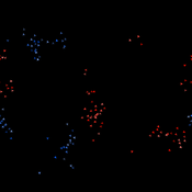
Peer reviewed Boyds (NetLogo): Boids That Fight
Oliver M. Haynold | Published Tuesday, January 20, 2026Boyds (Boids that Fight) is an agent-based model in NetLogo that extends the classic Flocking model with multi-faction competition, a local fight–flight heuristic, and a target locking/“taking” mechanism. The model separates perception (vision) from engagement range (lock distance) and uses per-faction steering bounds to explore how local numerical superiority, sensing, and bounded turning affect victory, losses, and emergent formations.
A modified model of breeding synchrony in colonial birds
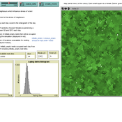
James Millington | Published Tuesday, June 26, 2012 | Last modified Saturday, April 27, 2013This generic individual-based model of a bird colony shows how the influence neighbour’s stress levels synchronize the laying date of neighbours and also of large colonies. The model has been used to demonstrate how this form of simulation model can be recognised as being ‘event-driven’, retaining a history in the patterns produced via simulated events and interactions.
Peer reviewed CHIME ABM of Hurricane Evacuation
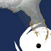
Sean Bergin C Michael Barton Joshua Watts Joshua Alland Rebecca Morss | Published Monday, October 18, 2021 | Last modified Tuesday, January 04, 2022The Communicating Hazard Information in the Modern Environment (CHIME) agent-based model (ABM) is a Netlogo program that facilitates the analysis of information flow and protective decisions across space and time during hazardous weather events. CHIME ABM provides a platform for testing hypotheses about collective human responses to weather forecasts and information flow, using empirical data from historical hurricanes. The model uses real world geographical and hurricane data to set the boundaries of the simulation, and it uses historical hurricane forecast information from the National Hurricane Center to initiate forecast information flow to citizen agents in the model.
Linear Threshold
Kaushik Sarkar | Published Saturday, November 03, 2012 | Last modified Saturday, April 27, 2013NetLogo implementation of Linear Threshold model of influence propagation.
Peer reviewed Agent-Based Model of Avian Movement and Functional Connectivity in Bogotá: Evaluating the 'Media Luna del Sur' Ecological Corridor (POT 2022–2035)
Maria Emilia Pelaez De Los Rios | Published Monday, September 14, 2026This NetLogo model simulates the movement and foraging behavior of 20 bird species (classified as urban avoiders or utilizers) across a 20×20m grid landscape representing southern Bogotá, Colombia. Agents follow an optimal foraging strategy (90% of the time) or move randomly (10%), gaining energy from land-cover-dependent food sources and dying if energy falls below their basal metabolic rate. The model compares two landscape scenarios — current land cover (2016) and a proposed scenario incorporating the ‘Media Luna del Sur’ ecological corridor from Bogotá’s 2022–2035 Land Use Plan (POT) — to evaluate whether the proposed green infrastructure improves functional connectivity for avian biodiversity across the urban matrix. Outputs include cumulative patch visitation counts, exported as raster files, used to generate connectivity heatmaps.
Displaying 10 of 205 results for "Nuno R Barros De Oliveira" clear search