Our mission is to help computational modelers develop, document, and share their computational models in accordance with community standards and good open science and software engineering practices. Model authors can publish their model source code in the Computational Model Library with narrative documentation as well as metadata that supports open science and emerging norms that facilitate software citation, computational reproducibility / frictionless reuse, and interoperability. Model authors can also request private peer review of their computational models. Models that pass peer review receive a DOI once published.
All users of models published in the library must cite model authors when they use and benefit from their code.
Please check out our model publishing tutorial and feel free to contact us if you have any questions or concerns about publishing your model(s) in the Computational Model Library.
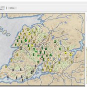
Displaying 10 of 156 results environment clear search
ThomondSim
Vinicius Marino Carvalho | Published Monday, April 25, 2022 | Last modified Friday, May 12, 2023ThomondSim is a simulation of the political and economic landscape of the medieval kingdom of Thomond, southwestern Ireland, between 1276 and 1318.
Its goal is to analyze how deteriorating environmental and economic conditions caused by the Little Ice Age (LIA), the Great European Famine of 1315-1322, and wars between England and Scotland affected the outcomes of a local war involving Gaelic and English aristocratic lineages.
This ABM attempts to model both the effects of devastation on the human environment and the modus operandi of late-medieval war and diplomacy.
The model is the digital counterpart of the science discovery board game The Triumphs of Turlough. Its procedures closely correspond to the game’s mechanics, to the point that ToT can be considered an interactive, analog version of this ABM.
ReMoTe-S. Residential Mobility of Tenants in Switzerland: an agent-based model
Claudia Binder Anna Pagani Francesco Ballestrazzi Emanuele Massaro | Published Friday, April 01, 2022ReMoTe-S is an agent-based model of the residential mobility of Swiss tenants. Its goal is to foster a holistic understanding of the reciprocal influence between households and dwellings and thereby inform a sustainable management of the housing stock. The model is based on assumptions derived from empirical research conducted with three housing providers in Switzerland and can be used mainly for two purposes: (i) the exploration of what if scenarios that target a reduction of the housing footprint while accounting for households’ preferences and needs; (ii) knowledge production in the field of residential mobility and more specifically on the role of housing functions as orchestrators of the relocation process.
Peer reviewed Two-stage migration decisions in a conceptual regions
Woi Sok Oh Alvaro Carmona Cabrero Rafael Muñoz-Carpena Rachata Muneepeerakul | Published Friday, April 01, 2022This proof-of-concept model explores the effects of how social and natural factors are incorporated (factor configuration) in environmentally induced migration. It is built in a conceptual environment where five regions are located in a row.
An Agent-Based Model of Insurance Customer Behaviour with Word of Mouth Network in C#
Rei England Iqbal Owadally Douglas Wright | Published Friday, March 04, 2022This is an agent-based model with two types of agents: customers and insurers. Insurers are price-takers who choose how much to spend on their service quality, and customers evaluate insurers based on premium, brand preference, and their perceived service quality. Customers are also connected in a small-world network and may share their opinions with their network.
The ABM contains two types of agents: insurers and customers. These act within the environment of a motor insurance market. At each simulation, the model undergoes the following steps:
- Network generation: At the start of the simulation, the model generates a small world network of social links between the customers, and randomly assigns each customer to an initial insurer ...
Peer reviewed Labor and environment in global value chains: An evolutionary policy study with a three-sector and two-region agent-based macroeconomic model
Lena Gerdes Manuel Scholz-Wäckerle Bernhard Rengs | Published Wednesday, December 22, 2021With this model, we investigate resource extraction and labor conditions in the Global South as well as implications for climate change originating from industry emissions in the North. The model serves as a testbed for simulation experiments with evolutionary political economic policies addressing these issues. In the model, heterogeneous agents interact in a self-organizing and endogenously developing economy. The economy contains two distinct regions – an abstract Global South and Global North. There are three interlinked sectors, the consumption good–, capital good–, and resource production sector. Each region contains an independent consumption good sector, with domestic demand for final goods. They produce a fictitious consumption good basket, and sell it to the households in the respective region. The other sectors are only present in one region. The capital good sector is only found in the Global North, meaning capital goods (i.e. machines) are exclusively produced there, but are traded to the foreign as well as the domestic market as an intermediary. For the production of machines, the capital good firms need labor, machines themselves and resources. The resource production sector, on the other hand, is only located in the Global South. Mines extract resources and export them to the capital firms in the North. For the extraction of resources, the mines need labor and machines. In all three sectors, prices, wages, number of workers and physical capital of the firms develop independently throughout the simulation. To test policies, an international institution is introduced sanctioning the polluting extractivist sector in the Global South as well as the emitting industrial capital good producers in the North with the aim of subsidizing innovation reducing environmental and social impacts.
The Agent-Based Wildfire Simulation Environment (ABWiSE) translates the concept of a moving fire front as a set of mobile fire agents that respond to, and interact with, vegetation, wind, and terrain. Presently, the purpose of ABWiSE is to explore how ABM, using simple interactions between agents and a simple atmospheric feedback model, can simulate emergent fire spread patterns.
Peer reviewed CHIME ABM of Hurricane Evacuation
C Michael Barton Sean Bergin Joshua Watts Joshua Alland Rebecca Morss | Published Monday, October 18, 2021 | Last modified Tuesday, January 04, 2022The Communicating Hazard Information in the Modern Environment (CHIME) agent-based model (ABM) is a Netlogo program that facilitates the analysis of information flow and protective decisions across space and time during hazardous weather events. CHIME ABM provides a platform for testing hypotheses about collective human responses to weather forecasts and information flow, using empirical data from historical hurricanes. The model uses real world geographical and hurricane data to set the boundaries of the simulation, and it uses historical hurricane forecast information from the National Hurricane Center to initiate forecast information flow to citizen agents in the model.
Sensitivity of a population submitted to floods to unknown upcoming floods and parameters of the dynamics
Sylvie Huet | Published Wednesday, September 22, 2021This work is a java implementation of a study of the viability of a population submitted to floods. The population derives some benefit from living in a certain environment. However, in this environment, floods can occur and cause damage. An individual protection measure can be adopted by those who wish and have the means to do so. The protection measure reduces the damage in case of a flood. However, the effectiveness of this measure deteriorates over time. Individual motivation to adopt this measure is boosted by the occurrence of a flood. Moreover, the public authorities can encourage the population to adopt this measure by carrying out information campaigns, but this comes at a cost. People’s decisions are modelled based on the Protection Motivation Theory (Rogers1975, Rogers 1997, Maddux1983) arguing that the motivation to protect themselves depends on their perception of risk, their capacity to cope with risk and their socio-demographic characteristics.
While the control designing proper informations campaigns to remain viable every time is computed in the work presented in https://www.comses.net/codebases/e5c17b1f-0121-4461-9ae2-919b6fe27cc4/releases/1.0.0/, the aim of the present work is to produce maps of probable viability in case the serie of upcoming floods is unknown as well as much of the parameters for the population dynamics. These maps are bi-dimensional, based on the value of known parameters: the current average wealth of the population and their actual or possible future annual revenues.
Multi-Hazard Coastal Agent-Based Model (MHCABM)
Andrew Allison | Published Thursday, August 05, 2021MHCABM is an agent-based, multi-hazard risk interaction model with an integrated applied dynamic adaptive pathways planning component. It is designed to explore the impacts of climate change adaptation decisions on the form and function of a coastal human-environment system, using as a case study an idealised patch based representation of the Mount North-Omanu area of Tauranga city, New Zealand. The interacting hazards represented are erosion, inundation, groundwater intrusion driven by intermittent heavy rainfall / inundations (storm) impacts, and sea level rise.
Peer reviewed Small-Trade Model
Emilie Lindkvist Maja Schlüter Blanca Gonzalez-Mon Örjan Bodin | Published Wednesday, July 28, 2021The purpose of this model is to understand the role of trade networks and their interaction with different fish resources, for fish provision. The model is developed based on a multi-methods approach, combining agent-based modeling, network analysis and qualitative data based on a small-scale fisheries study case. The model can be used to investigate both how trade network structures are embedded in a social-ecological context and the trade processes that occur within them, to analyze how they lead to emergent outcomes related to the resilience of fish provision. The model processes are informed by qualitative data analysis, and the social network analysis of an empirical fish trade network. The network analysis can be used to investigate diverse network structures to perform model experiments, and their influence on model outcomes.
The main outcomes we study are 1) the overexploitation of fish resources and 2) the availability and variability of fish provision to satisfy different market demands, and 3) individual traders’ fish supply at the micro-level. The model has two types of trader agents, seller and dealer. The model reveals that the characteristics of the trade networks, linked to different trader types (that have different roles in those networks), can affect the resilience of fish provision.
Displaying 10 of 156 results environment clear search