Our mission is to help computational modelers develop, document, and share their computational models in accordance with community standards and good open science and software engineering practices. Model authors can publish their model source code in the Computational Model Library with narrative documentation as well as metadata that supports open science and emerging norms that facilitate software citation, computational reproducibility / frictionless reuse, and interoperability. Model authors can also request private peer review of their computational models. Models that pass peer review receive a DOI once published.
All users of models published in the library must cite model authors when they use and benefit from their code.
Please check out our model publishing tutorial and feel free to contact us if you have any questions or concerns about publishing your model(s) in the Computational Model Library.
Displaying 10 of 346 results for "Michael D. Slater" clear search
In-group favoritism due to friend selection strategies based on fixed tag and within-group reputation
Yutaka Nakai | Published Friday, March 28, 2014 | Last modified Friday, March 28, 2014An agent-based model simulates emergence of in-group favoritism. Agents adopt friend selection strategies using an invariable tag and reputations meaning how cooperative others are to a group. The reputation can be seen as a kind of public opinion.
Spatiotemporal Visualization of Emotional and Emotional-related Mental States
Luis Macedo | Published Monday, November 07, 2011 | Last modified Saturday, April 27, 2013A system that receives from an agent-based social simulation the agent’s emotional data, their emotional-related data such as motivations and beliefs, as well as their location, and visualizes of all this information in a two dimensional map of the geographic region the agents inhabit as well as on graphs along the time dimension.
Potato late blight model
Francine Pacilly | Published Friday, April 13, 2018The purpose of the model is to simulate the spatial dynamics of potato late blight to analyse whether resistant varieties can be used effectively for sustainable disease control. The model represents an agricultural landscape with potato fields and data of a Dutch agricultural region is used as input for the model. We simulated potato production, disease spread and pathogen evolution during the growing season (April to September) for 36 years. Since late blight development and crop growth is weather dependent, measured weather data is used as model input. A susceptible and late blight resistant potato variety are distinguished. The resistant variety has a potentially lower yield but cannot get infected with the disease. However, during the growing season virulent spores can emerge as a result of mutations during spore production. This new virulent strain is able to infect the resistant fields, resulting in resistance breakdown. The model shows how disease severity, resistance durability and potato yield are affected by the fraction of fields across a landscape with a disease-resistant potato variety.
Fragile, Resilient, Asymmetric: An Agent-Based Stress Test of European Cooperation under Geopolitical Shocks (2024-2040)
Alessandro Brugnoletti | Published Thursday, July 16, 2026An empirically calibrated agent-based model of cooperation among 14 EU member states. Adaptive state-agents update their cooperation propensity through behavioural inertia, influence along the observed intra-EU trade network (IMF bilateral flows), and repeated-game payoff indicators built from verified Eurostat, Eurobarometer and IMF data (2021-2024). An anchored logistic mapping makes the observed configuration stationary in the absence of shocks, so outcomes read as deviations from the empirical baseline. The model stress-tests European cooperation to 2040 under five scenarios of increasing severity, from a baseline to a Taiwan Strait crisis counterfactual, with 1,000 Monte Carlo replications and a full sensitivity suite (one-factor-at-a-time, joint parameter sampling, breaking-point analysis, alternative functional form). Documented with the ODD protocol; self-testing and fully reproducible under fixed seeds.
Hominin ecodynamics v.2
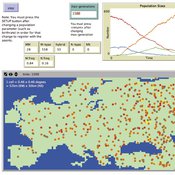
C Michael Barton | Published Monday, September 19, 2011 | Last modified Friday, March 28, 2014Simulates biobehavioral interactions between 2 populations of hominins.
Peer reviewed BAM: The Bottom-up Adaptive Macroeconomics Model
Alejandro Platas López Alejandro Guerra-Hernández | Published Tuesday, January 14, 2020 | Last modified Sunday, July 26, 2020Overview
Purpose
Modeling an economy with stable macro signals, that works as a benchmark for studying the effects of the agent activities, e.g. extortion, at the service of the elaboration of public policies..
…
Asymmetric Demographic Hysteresis in a Spatial Agent-Based Urban System
Chen Shen | Published Friday, July 24, 2026This paper develops a spatial agent-based model to examine how fertility regime shifts reshape population concentration and wealth distribution in an abstract urban system. Migration decisions combine population preference, cultural homophily, expected net income, and resource endowment through a standardised softmax utility. The design is deliberately stylised: it is not calibrated to a particular country or city system, but is intended to isolate the feedbacks linking migration, fertility, urban scaling, and accumulated wealth.
The simulations reveal robust directional asymmetry. When fertility shifts from low to high, population concentration responds rapidly; when fertility shifts from high to low, concentration declines only after a detectable delay and may temporarily continue in the previous direction. Wealth adds a second layer of hysteresis: cell total-wealth concentration follows population concentration with delay, cell mean-wealth inequality and system-level wealth indicators are slower still, and phase-space trajectories form loops rather than collapsing onto a single population–wealth curve. Robustness experiments indicate that longer fertility cycles, wider mobility neighbourhoods, and smoother resource landscapes change the magnitude of delay and overshoot, but do not remove the qualitative asymmetry. The paper argues that demographic decline should be understood not as the mirror image of demographic expansion, but as a path-dependent transition mediated by fast migration-income feedbacks and slower fertility, cohort, culture, and wealth mechanisms.
Peer reviewed An extended replication of Abelson's and Bernstein's community referendum simulation
Klaus G. Troitzsch | Published Friday, October 25, 2019 | Last modified Friday, August 25, 2023This is an extended replication of Abelson’s and Bernstein’s early computer simulation model of community referendum controversies which was originally published in 1963 and often cited, but seldom analysed in detail. This replication is in NetLogo 6.3.0, accompanied with an ODD+D protocol and class and sequence diagrams.
This replication replaces the original scales for attitude position and interest in the referendum issue which were distributed between 0 and 1 with values that are initialised according to a normal distribution with mean 0 and variance 1 to make simulation results easier compatible with scales derived from empirical data collected in surveys such as the European Value Study which often are derived via factor analysis or principal component analysis from the answers to sets of questions.
Another difference is that this model is not only run for Abelson’s and Bernstein’s ten week referendum campaign but for an arbitrary time in order that one can find out whether the distributions of attitude position and interest in the (still one-dimensional) issue stabilise in the long run.
MERCURY extension: population
Tom Brughmans | Published Thursday, May 23, 2019This model is an extended version of the original MERCURY model (https://www.comses.net/codebases/4347/releases/1.1.0/ ) . It allows for experiments to be performed in which empirically informed population sizes of sites are included, that allow for the scaling of the number of tableware traders with the population of settlements, and for hypothesised production centres of four tablewares to be used in experiments.
Experiments performed with this population extension and substantive interpretations derived from them are published in:
Hanson, J.W. & T. Brughmans. In press. Settlement scale and economic networks in the Roman Empire, in T. Brughmans & A.I. Wilson (ed.) Simulating Roman Economies. Theories, Methods and Computational Models. Oxford: Oxford University Press.
…
Peer reviewed WaDemEsT-Water Demand Estimation Tool for Residential Areas
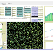
Kamil Aybuğa | Published Tuesday, February 18, 2025This model simulates household water consumption patterns in an urban environment. Its current setup compares monthly water consumption data, and the results of a daily heuristic water demand model with the simulation results produced by household demographics that is fine tuned via some base demand model. It’s designed to estimate and analyze water demand based on various factors including household demographics, daily routines of residents (working, weekending, vacation patterns), weather conditions (temperature and precipitation), appliance usage patterns, seasonal variations, and special periods such as weekends and holidays. The model aims to help understand how different factors influence residential water consumption and can be used for water demand forecasting and management.
Displaying 10 of 346 results for "Michael D. Slater" clear search