Our mission is to help computational modelers develop, document, and share their computational models in accordance with community standards and good open science and software engineering practices. Model authors can publish their model source code in the Computational Model Library with narrative documentation as well as metadata that supports open science and emerging norms that facilitate software citation, computational reproducibility / frictionless reuse, and interoperability. Model authors can also request private peer review of their computational models. Models that pass peer review receive a DOI once published.
All users of models published in the library must cite model authors when they use and benefit from their code.
Please check out our model publishing tutorial and feel free to contact us if you have any questions or concerns about publishing your model(s) in the Computational Model Library.
Displaying 10 of 543 results for "Mark Orr" clear search
Construction and Demolition model to track material flows and embodied carbon
Jonathan Edgardo Cohen | Published Monday, September 30, 2024Reusing existing material stocks in developed built environments can significantly reduce the environmental footprint of the construction and demolition sector. However, material reuse in urban areas presents technical, temporal, and geographical challenges. Although a better understanding of spatial and temporal changes in material stocks could improve city resource management, limited scientific contributions have addressed this challenge.
This study details the steps followed in developing a spatially explicit rule-based simulation of materials stock. The simulation provides a proof of concept by incorporating the spatial and temporal dimensions of construction and demolition activities to analyse how various urban parameters determine material flows and embodied carbon in urban areas. The model explores the effects of 1) re-using recycled materials, 2) demolitions, 3) renovations and 4) various building typologies.
To showcase the model’s capabilities, the residential building stock of Gothenburg City is used as a case study, and eight building materials are tracked. Environmental impacts (A1-A3) are calculated with embodied carbon factors. The main parameters are explored in a baseline scenario. Then, a second scenario focuses on a hypothetical policy that promotes improvements in building energy performance.
The simulation can be expanded to include more materials and built environment assets and allows for future explorations on, for example, the role of logistics, the implementation of recycling or reuse stations, and, in general, supporting sustainable and circular strategies from the construction sector.
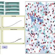
Simulating Climate Stress and Social Instability: An Agent-Based Model of Ecosystem Degradation and Violence in Coastal Communities
Jacopo A. Baggio hurtado-valdivieso | Published Sunday, April 12, 2026This model is an agent-based simulation designed to explore how climate-induced environmental degradation can contribute to the emergence of social violence in coastal communities that depend heavily on ecosystem services for their livelihoods. The model represents a coupled social–ecological system in which environmental shocks—such as sea level rise and marine ecosystem decline—affect local economic conditions, food security, and community stability.
Agents in the model represent individuals whose livelihoods depend on coastal ecosystems. Environmental degradation reduces ecosystem productivity and increases economic hardship, which can lead to the formation of grievances among agents. The model incorporates behavioral thresholds that determine how individuals respond to hardship and perceived injustice. Under certain conditions—particularly when institutional capacity and law enforcement effectiveness are limited—these grievances may escalate into violent behavior.
The simulation allows users to explore how different climate scenarios, levels of ecosystem degradation, livelihood dependence, and institutional responses influence the probability of social instability and violence. By modeling the interactions between environmental stress, socio-economic vulnerability, and governance capacity, the model provides a computational framework for examining potential pathways linking climate change and conflict in coastal social–ecological systems.
…
Asymmetric Demographic Hysteresis in a Spatial Agent-Based Urban System
Chen Shen | Published Friday, July 24, 2026This paper develops a spatial agent-based model to examine how fertility regime shifts reshape population concentration and wealth distribution in an abstract urban system. Migration decisions combine population preference, cultural homophily, expected net income, and resource endowment through a standardised softmax utility. The design is deliberately stylised: it is not calibrated to a particular country or city system, but is intended to isolate the feedbacks linking migration, fertility, urban scaling, and accumulated wealth.
The simulations reveal robust directional asymmetry. When fertility shifts from low to high, population concentration responds rapidly; when fertility shifts from high to low, concentration declines only after a detectable delay and may temporarily continue in the previous direction. Wealth adds a second layer of hysteresis: cell total-wealth concentration follows population concentration with delay, cell mean-wealth inequality and system-level wealth indicators are slower still, and phase-space trajectories form loops rather than collapsing onto a single population–wealth curve. Robustness experiments indicate that longer fertility cycles, wider mobility neighbourhoods, and smoother resource landscapes change the magnitude of delay and overshoot, but do not remove the qualitative asymmetry. The paper argues that demographic decline should be understood not as the mirror image of demographic expansion, but as a path-dependent transition mediated by fast migration-income feedbacks and slower fertility, cohort, culture, and wealth mechanisms.
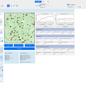
Peer reviewed MOSAIC: Mission-Oriented Self-Organization through Auctions, Incentives, and Coalitions
Katherin Molina Lorena Holguin | Published Friday, July 31, 2026 | Last modified Thursday, August 20, 2026MOSAIC is an agent-based NetLogo model of decentralized mission coordination among heterogeneous robots operating under partial observability, limited energy, spatially variable risk, dynamic communication, and individual and cooperative task requirements. Robots discover tasks locally, exchange task information through temporary communication links, submit capability-, energy-, deadline-, and risk-aware bids, compete for individual contracts, and form temporary coalitions for cooperative tasks.
The model integrates decentralized auctions, greedy capability-based coalition formation, contract release and reassignment, four reward regimes, reputation, adaptive bidding strategies, failure traceability, and mission-, network-, information-, inequality-, and coalition-level metrics. It operates without a centralized mission planner or global combinatorial assignment solver.
Seven paired-seed BehaviorSpace experiments comprising 690 official simulation runs evaluate baseline mission viability, reward regimes, communication structure, capability heterogeneity, cooperative-task demand, reputation and adaptive strategies, and mission-incentive strength. The results indicate that structural coordination capacity—particularly information reach, capability compatibility, and feasible coalition construction—has a stronger effect on mission completion than increasing incentive intensity within the tested architecture and parameter ranges.
…
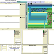
Human Environment Estuarine Systems Investigator
Andrew Allison | Published Friday, February 26, 2021This model simulates the form and function of an idealised estuary with associated barrier-spit complex on the north east coast of New Zealand’s North Island (from Bream Bay to central Bay of Plenty) during the years 2010 - 2050 CE. It combines variables from social, ecological and geomorphic systems to simulate potential directions of change in shallow coastal systems in response to external forcing from land use, climate, pollution, population density, demographics, values and beliefs. The estuary is over 1000Ha, making it a large estuary according to Hume et al. (2007) - there are 12 large estuaries in the Auckland region alone (Suyadi et al., 2019). The model was developed as part of Andrew Allison’s PhD Thesis in Geography from the School of Environment and Institute of Marine Science, University of Auckland, New Zealand. The model setup allows for alteration of geomorphic, ecological and social variables to suit the specific conditions found in various estuaries along the north east coast of New Zealand’s North Island.
This model is not a predictive or forecasting model. It is designed to investigate potential directions of change in complex shallow coastal systems. This model must not be used for any purpose other than as a heuristic to facilitate researcher and stakeholder learning and for developing system understanding (as per Allison et al., 2018).
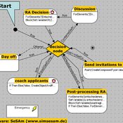
NarrABS
Tilman Schenk | Published Thursday, September 20, 2012 | Last modified Saturday, April 27, 2013An agent based simulation of a political process based on stakeholder narratives
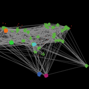
Peer reviewed Hohokam Trade Networks Model
Joshua Watts | Published Sunday, October 26, 2014The Hohokam Trade Networks Model focuses on key features of the Hohokam economy to explore how differences in trade network topologies may show up in the archaeological record. The model is set in the Phoenix Basin of central Arizona, AD 200-1450.
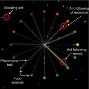
Composite Collective Decision Making - ant colony foraging model
Tomer Czaczkes Benjamin I Czaczkes | Published Thursday, December 17, 2015The model explores how two types of information - social (in the form of pheromone trails) and private (in the form of route memories) affect ant colony level foraging in a variable enviroment.
Relative Agreement Model and Network Structure
Spiro Maroulis David Adelberg | Published Friday, January 29, 2016This adaptation of the Relative Agreement model of opinion dynamics (Deffuant et al. 2002) extends the Meadows and Cliff (2012) implementation of this model in a manner that explores the effect of the network structure among the agents.
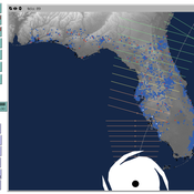
Peer reviewed CHIME ABM Hurricane Evacuation Model
Joshua Watts | Published Friday, March 03, 2017 | Last modified Wednesday, May 29, 2019The CHIME ABM explores information distribution networks and agents’ protective decision making in the context of hurricane landfall.
Displaying 10 of 543 results for "Mark Orr" clear search