About the CoMSES Model Library more info
Our mission is to help computational modelers develop, document, and share their computational models in accordance with community standards and good open science and software engineering practices. Model authors can publish their model source code in the Computational Model Library with narrative documentation as well as metadata that supports open science and emerging norms that facilitate software citation, computational reproducibility / frictionless reuse, and interoperability. Model authors can also request private peer review of their computational models. Models that pass peer review receive a DOI once published.
All users of models published in the library must cite model authors when they use and benefit from their code.
Please check out our model publishing tutorial and feel free to contact us if you have any questions or concerns about publishing your model(s) in the Computational Model Library.
We also maintain a curated database of over 7500 publications of agent-based and individual based models with detailed metadata on availability of code and bibliometric information on the landscape of ABM/IBM publications that we welcome you to explore.
Displaying 10 of 228 results Netlogo clear search
PowerGen-ABM
Muhammad Indra Al Irsyad Anthony Halog Rabindra Nepal Deddy Priatmodjo Koesrindartoto | Published Sunday, August 04, 2019PowerGen-ABM is an optimisation model for power plant expansions from 2010 to 2025 with Indonesian electricity systems as the case study. PowerGen-ABM integrates three approaches: techno-economic analysis (TEA), linear programming (LP), and input-output analysis (IOA) and environmental analysis. TEA is based on the revenue requirement (RR) formula by UCDavis (2016), and the environmental analysis accounts for resource consumption (i.e., steel, concrete, aluminium, and energy) and carbon dioxide equivalent (CO2e) emissions during the construction and operational stages of power plants.
An Agent-Based Model of Language Contact
Marco Civico | Published Tuesday, July 30, 2019This model is part of an article that discusses the adoption of a complexity theory approach to study the dynamics of language contact within multilingual communities. The model simulates the dynamics of communication within a community where a minority and a majority group coexist. The individual choice of language for communication is based on a number of simple rules derived from a review of the main literature on the topic of language contact. These rules are then combined with different variables, such as the rate of exogamy of the minority group and the presence of relevant education policies, to estimate the trends of assimilation of the minority group into the majority one. The model is validated using actually observed data from the case of Romansh speakers in the canton of Grisons, Switzerland.
Agent-based Model of Industrial Evolution
Martin Zoričak Denis Horvath Vladimir Gazda Oto Hudec | Published Wednesday, July 10, 2019This is a conceptual model of underlying forces creating industrial clusters. There are two contradictory forces - attraction and repulsion. Firms within the same Industry are attracted to each other and on the other hand, firms with the same Activity are repulsed from each other. In each round firm with the lowest fitness is selected to change its profile of Industries and Activities. Based on these simple rules interesting patterns emerge.
An agent-based artificial stock with a dynamic investor network
Matthew Oldham | Published Tuesday, June 25, 2019The model is an agent-based artificial stock market where investors connect in a dynamic network. The network is dynamic in the sense that the investors, at specified intervals, decide whether to keep their current adviser (those investors they receive trading advise from). The investors also gain information from a private source and share public information about the risky asset. Investors have different tendencies to follow the different information sources, consider differing amounts of history, and have different thresholds for investing.
Individual-based modelling as a tool for elephant poaching mitigation
Ernesto Carrella Richard Bailey Emily Neil Jens Koed Madsen Nicolas Payette | Published Tuesday, June 18, 2019 | Last modified Thursday, August 01, 2019We develop an IBM that predicts how interactions between elephants, poachers, and law enforcement affect poaching levels within a virtual protected area. The model is theoretical at this stage and is not meant to provide a realistic depiction of poaching, but instead to demonstrate how IBMs can expand upon the existing modelling work done in this field, and to provide a framework for future research. The model could be further developed into a useful management support tool to predict the outcomes of various poaching mitigation strategies at real-world locations. The model was implemented in NetLogo version 6.1.0.
We first compared a scenario in which poachers have prescribed, non-adaptive decision-making and move randomly across the landscape, to one in which poachers adaptively respond to their memories of elephant locations and where other poachers have been caught by law enforcement. We then compare a situation in which ranger effort is distributed unevenly across the protected area to one in which rangers patrol by adaptively following elephant matriarchal herds.
MERCURY extension: population
Tom Brughmans | Published Thursday, May 23, 2019This model is an extended version of the original MERCURY model (https://www.comses.net/codebases/4347/releases/1.1.0/ ) . It allows for experiments to be performed in which empirically informed population sizes of sites are included, that allow for the scaling of the number of tableware traders with the population of settlements, and for hypothesised production centres of four tablewares to be used in experiments.
Experiments performed with this population extension and substantive interpretations derived from them are published in:
Hanson, J.W. & T. Brughmans. In press. Settlement scale and economic networks in the Roman Empire, in T. Brughmans & A.I. Wilson (ed.) Simulating Roman Economies. Theories, Methods and Computational Models. Oxford: Oxford University Press.
…
ABM Household Decision Making on Solar Energy using Theory of Planned Behaviour
Tatiana Filatova Hannah Muelder | Published Tuesday, May 21, 2019The model aims at estimating household energy consumption and the related greenhouse gas (GHG) emissions reduction based on the behavior of the individual household under different operationalizations of the Theory of Planned Behaviour (TPB).
The original model is developed as a tool to explore households decisions regarding solar panel investments and cumulative consequences of these individual choices (i.e. diffusion of PVs, regional emissions savings, monetary savings). We extend the model to explore a methodological question regarding an interpretation of qualitative concepts from social science theories, specifically Theory of Planned Behaviour in a formal code of quantitative agent-based models (ABMs). We develop 3 versions of the model: one TPB-based ABM designed by the authors and two alternatives inspired by the TPB-ABM of Schwarz and Ernst (2009) and the TPB-ABM of Rai and Robinson (2015). The model is implemented in NetLogo.
The code shared here accompanies the paper at https://doi.org/10.1371/journal.pone.0208451. It simulates the effects of various economic trade scenarios on the phenomenon of the ‘disappearing middle’ in the Scottish beef and dairy farming industries. The ‘disappearing middle’ is a situation in which there is a simultaneous observed decline in medium-sized enterprises and rise in the number of small and large-scale enterprises.
Model for decision making of farmers to vaccinate against blue tongue virus
Egil Fischer | Published Wednesday, April 24, 2019This model combines decision making models of individual farmers with a model of the spatial spread between farms of blue tongue virus.
Mission San Diego Model
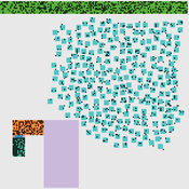
Carolyn Orbann | Published Monday, April 15, 2019The Mission San Diego model is an epidemiological model designed to test hypotheses related to the spread of the 1805-1806 measles epidemic among indigenous residents of Mission San Diego during the early mission period in Alta California. The model community is based on the population of the Mission San Diego community, as listed in the parish documents (baptismal, marriage, and death records). Model agents are placed on a map-like grid that consists of houses, the mission church, a women’s dormitory (monjeria) adjacent to the church, a communal kitchen, priest’s quarters, and agricultural fields. They engage in daily activities that reflect known ethnographic patterns of behavior at the mission. A pathogen is introduced into the community and then it spreads throughout the population as a consequence of individual agent movements and interactions.
Displaying 10 of 228 results Netlogo clear search

