Our mission is to help computational modelers develop, document, and share their computational models in accordance with community standards and good open science and software engineering practices. Model authors can publish their model source code in the Computational Model Library with narrative documentation as well as metadata that supports open science and emerging norms that facilitate software citation, computational reproducibility / frictionless reuse, and interoperability. Model authors can also request private peer review of their computational models. Models that pass peer review receive a DOI once published.
All users of models published in the library must cite model authors when they use and benefit from their code.
Please check out our model publishing tutorial and feel free to contact us if you have any questions or concerns about publishing your model(s) in the Computational Model Library.
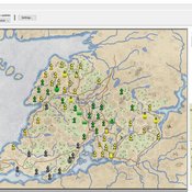
Displaying 10 of 95 results landscape clear search
Superiority Bias and Communication Noise in a Model of Collective Problem Solving
Paul Smaldino Amin Boroomand | Published Sunday, May 01, 2022This model aims to examine how different levels of communication noise and superiority bias affect team performance when solving problems collectively. We used a networked agent-based model of collective problem solving in which agents explore the NK landscape for a better solution and communicate with each other regarding their current solutions. We compared the team performance in solving problems collectively at different levels of self-superiority bias when facing simple and complex problems. Additionally, we addressed the effect of different levels of communication noise on the team’s outcome
ThomondSim
Vinicius Marino Carvalho | Published Monday, April 25, 2022 | Last modified Friday, May 12, 2023ThomondSim is a simulation of the political and economic landscape of the medieval kingdom of Thomond, southwestern Ireland, between 1276 and 1318.
Its goal is to analyze how deteriorating environmental and economic conditions caused by the Little Ice Age (LIA), the Great European Famine of 1315-1322, and wars between England and Scotland affected the outcomes of a local war involving Gaelic and English aristocratic lineages.
This ABM attempts to model both the effects of devastation on the human environment and the modus operandi of late-medieval war and diplomacy.
The model is the digital counterpart of the science discovery board game The Triumphs of Turlough. Its procedures closely correspond to the game’s mechanics, to the point that ToT can be considered an interactive, analog version of this ABM.
The Agent-Based Wildfire Simulation Environment (ABWiSE) translates the concept of a moving fire front as a set of mobile fire agents that respond to, and interact with, vegetation, wind, and terrain. Presently, the purpose of ABWiSE is to explore how ABM, using simple interactions between agents and a simple atmospheric feedback model, can simulate emergent fire spread patterns.
The Effect of Individual and Collective Characteristics on Team Performance: A Model of Networked Agents Engaged in Collective Problem Solving
Amin Boroomand | Published Tuesday, March 16, 2021 | Last modified Monday, July 26, 2021This code is for an agent-based model of collective problem solving in which agents with different behavior strategies, explore the NK landscape while they communicate with their peers agents. This model is based on the famous work of Lazer, D., & Friedman, A. (2007), The network structure of exploration and exploitation.
Peer reviewed Evolution of Ecological Communities: Testing Constraint Closure
Steve Peck | Published Sunday, December 06, 2020 | Last modified Friday, April 16, 2021Ecosystems are among the most complex structures studied. They comprise elements that seem both stable and contingent. The stability of these systems depends on interactions among their evolutionary history, including the accidents of organisms moving through the landscape and microhabitats of the earth, and the biotic and abiotic conditions in which they occur. When ecosystems are stable, how is that achieved? Here we look at ecosystem stability through a computer simulation model that suggests that it may depend on what constrains the system and how those constraints are structured. Specifically, if the constraints found in an ecological community form a closed loop, that allows particular kinds of feedback may give structure to the ecosystem processes for a period of time. In this simulation model, we look at how evolutionary forces act in such a way these closed constraint loops may form. This may explain some kinds of ecosystem stability. This work will also be valuable to ecological theorists in understanding general ideas of stability in such systems.
Change and Senescence
André Martins | Published Tuesday, November 10, 2020Agers and non-agers agent compete over a spatial landscape. When two agents occupy the same grid, who will survive is decided by a random draw where chances of survival are proportional to fitness. Agents have offspring each time step who are born at a distance b from the parent agent and the offpring inherits their genetic fitness plus a random term. Genetic fitness decreases with time, representing environmental change but effective non-inheritable fitness can increase as animals learn and get bigger.
PaCE Austria Pilot Model
Ruth Meyer | Published Tuesday, June 30, 2020The objective of building a social simulation in the Populism and Civic Engagement (PaCE) project is to study the phenomenon of populism by mapping individual level political behaviour and explain the influence of agents on, and their interdependence with the respective political parties. Voters, political parties and – to some extent – the media can be viewed as forming a complex adaptive system, in which parties compete for citizens’ votes, voters decide on which party to vote for based on their respective positions with regard to particular issues, and the media may influence the salience of issues in the public debate.
This is the first version of a model exploring voting behaviour in Austria. It focusses on modelling the interaction of voters and parties in a political landscape; the effects of the media are not yet represented. Austria was chosen as a case study because it has an established populist party (the “Freedom Party” FPO), which has even been part of the government over the years.
A simple model that aims to demonstrate the influence of agri-environmental payments on land-use patterns in a virtual landscape. The landscape consists of grassland (which can be managed extensively or intensively) and a river. Agri-environmental payments are provided for extensive management of grassland. Additionally, there are boni for (a) extensive grassland in proximity of the river; and (b) clusters (“agglomerations”) of extensive grassland. The farmers, who own randomly distributed grassland patches, make decisions either on the basis of simple income maximization or they maximize only up to an income threshold beyond which they seize making changes in management. The resulting landscape pattern is evaluated by means of three simple models for (a) agricultural yield, (b) habitat/biodiversity and (c) water quality. The latter two correspond to the two boni. The model has been developed within a small project called Aligning Agent-Based Modelling with Multi-Objective Land-Use Allocation (ALABAMA).
Rangeland and evolution of management styles
Marco Janssen | Published Tuesday, January 14, 2020Provided is a landscape of properties where pastoralists make decisions how much livestock they put on their property and how much to suppress fire from occuring. Rangelands can be grass dominated, or unproductive shrubb dominated. Overgrazing and fire suppresion lead to shrub dominated landscapes. What management strategies evolve, and how is this impacted by policies?
The model is discussed in Introduction to Agent-Based Modeling by Marco Janssen. For more information see https://intro2abm.com/.
Sugarscape with spice
Marco Janssen | Published Tuesday, January 14, 2020 | Last modified Friday, September 18, 2020This is a variation of the Sugarspace model of Axtell and Epstein (1996) with spice and trade of sugar and spice. The model is not an exact replication since we have a somewhat simpler landscape of sugar and spice resources included, as well as a simple reproduction rule where agents with a certain accumulated wealth derive an offspring (if a nearby empty patch is available).
The model is discussed in Introduction to Agent-Based Modeling by Marco Janssen. For more information see https://intro2abm.com/
Displaying 10 of 95 results landscape clear search