Our mission is to help computational modelers develop, document, and share their computational models in accordance with community standards and good open science and software engineering practices. Model authors can publish their model source code in the Computational Model Library with narrative documentation as well as metadata that supports open science and emerging norms that facilitate software citation, computational reproducibility / frictionless reuse, and interoperability. Model authors can also request private peer review of their computational models. Models that pass peer review receive a DOI once published.
All users of models published in the library must cite model authors when they use and benefit from their code.
Please check out our model publishing tutorial and feel free to contact us if you have any questions or concerns about publishing your model(s) in the Computational Model Library.
Displaying 10 of 95 results landscape clear search
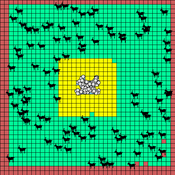
HMODEL: an exploratory simulation of surface archaeological formation
Benjamin Davies Simon Holdaway Patricia Fanning | Published Thursday, November 30, 2017This model is used to simulate the influence of spatially and temporally variable sedimentary processes on the distribution of dated archaeological features in a surface context.
The Cardial Spread Model
Sean Bergin | Published Friday, September 29, 2017 | Last modified Monday, February 04, 2019The purpose of this model is to provide a platform to test and compare four conceptual models have been proposed to explain the spread of the Impresso-Cardial Neolithic in the west Mediterranean.
Coastal Coupled Housing and Land Markets (C-CHALMS)
Nicholas Magliocca | Published Thursday, May 18, 2017Next generation of the CHALMS model applied to a coastal setting to investigate the effects of subjective risk perception and salience decision-making on adaptive behavior by residents.
Peer reviewed The Effect of Spatial Clustering on Stone Raw Material Procurement
Marco Janssen Simen Oestmo Curtis W Marean | Published Friday, April 21, 2017This model allows for the investigation of the effect spatial clustering of raw material sources has on the outcome of the neutral model of stone raw material procurement by Brantingham (2003).
TERRoir level Organic matter Interactions and Recycling model
Myriam Grillot | Published Wednesday, April 19, 2017 | Last modified Wednesday, June 17, 2020The TERROIR agent-based model was built for the multi-level analysis of biomass and nutrient flows within agro-sylvo-pastoral villages in West Africa. It explicitly takes into account both human organization and spatial extension of such flows.
Success bias imitation increases the probability of effectively dealing with ecological disturbances
Jacopo A. Baggio Vicken Hillis | Published Thursday, April 13, 2017 | Last modified Thursday, August 02, 2018This model aims to investigate how different type of learning (social system) and disturbance specific attributes (ecological system) influence adoption of treatment strategies to treat the effects of ecological disturbances.
Peer reviewed MOOvPOP
Matthew Gompper Aniruddha Belsare Joshua J Millspaugh | Published Monday, April 10, 2017 | Last modified Saturday, April 19, 2025MOOvPOP is designed to simulate population dynamics (abundance, sex-age composition and distribution in the landscape) of white-tailed deer (Odocoileus virginianus) for a selected sampling region.
Peer reviewed MOOvPOPsurveillance
Matthew Gompper Aniruddha Belsare Joshua J Millspaugh | Published Tuesday, April 04, 2017 | Last modified Tuesday, May 12, 2020MOOvPOPsurveillance was developed as a tool for wildlife agencies to guide collection and analysis of disease surveillance data that relies on non-probabilistic methods like harvest-based sampling.
Peer reviewed DogFoxCDVspillover
Aniruddha Belsare Matthew Gompper | Published Thursday, March 16, 2017 | Last modified Tuesday, April 04, 2017The purpose of this model is to better understand the dynamics of a multihost pathogen in two host system comprising of high densities of domestic hosts and sympatric wildlife hosts susceptible to the pathogen.
Managing ecological disturbances: Learning and the structure of social-ecological networks
Jacopo A. Baggio Vicken Hillis | Published Friday, March 03, 2017 | Last modified Thursday, August 02, 2018The aim of this model is to explore and understand the factors driving adoption of treatment strategies for ecological disturbances, considering payoff signals, learning strategies and social-ecological network structure
Displaying 10 of 95 results landscape clear search