Our mission is to help computational modelers develop, document, and share their computational models in accordance with community standards and good open science and software engineering practices. Model authors can publish their model source code in the Computational Model Library with narrative documentation as well as metadata that supports open science and emerging norms that facilitate software citation, computational reproducibility / frictionless reuse, and interoperability. Model authors can also request private peer review of their computational models. Models that pass peer review receive a DOI once published.
All users of models published in the library must cite model authors when they use and benefit from their code.
Please check out our model publishing tutorial and feel free to contact us if you have any questions or concerns about publishing your model(s) in the Computational Model Library.
Displaying 10 of 49 results water clear search
Aqua.MORE
Lisa Ambrosi Nico Bahro | Published Wednesday, November 20, 2019 | Last modified Saturday, July 03, 2021Aqua.MORE (Agent-based MOdelling of REsources in Socio-Hydrological Systems) is an agent based modelling (ABM) approach to simulate the resource flow and social interaction in a coupled natural and social system of water supply and demand. The model is able to simulate the two-way feedback as socio-economic agents influence the natural resource flow and the availability of this resource influences the agents in their behaviour.
Peer reviewed COMMAND-AND-CONTROL
Farzaneh Davari | Published Tuesday, September 10, 2019 | Last modified Thursday, September 12, 2019The command and control policy in natural resource management, including water resources, is a longstanding established policy that has been theoretically and practically argued from the point of view of social-ecological complex systems. With the intention of making a system ecologically resilient, these days, policymakers apply the top-down policies of controlling communities through regulations. To explore how these policies may work and to understand whether the ecological goal can be achieved via command and control policy, this research uses the capacity of Agent-Based Modeling (ABM) as an experimental platform in the Urmia Lake Basin (ULB) in Iran, which is a social-ecological complex system and has gone through a drought process.
Despite the uncertainty of the restorability capacity of the lake, there has been a consensus on the possibility to artificially restore the lake through the nationally managed Urmia Lake Restoratoin Program (ULRP). To reduce water consumption in the Basin, the ULRP widely targets the agricultural sector and proposes the project of changing crop patterns from high-water-demand (HWD) to low-water-demand (LWD), which includes a component to control water consumption by establishing water-police forces.
Using a wide range of multidisciplinary studies about Urmia Lake at the Basin and sub-basins as well as qualitative information at micro-level as the main conceptual sources for the ABM, the findings under different strategies indicate that targeting crop patterns change by legally limiting farmers’ access to water could force farmers to change their crop patterns for a short period of time as long as the number of police constantly increases. However, it is not a sustainable policy for either changing the crop patterns nor restoring the lake.
TIP TOP Landscape
Patrick Taillandier Nesrine Ayari Claude Janin Benoit Sarrazin Dominique Trévisan | Published Wednesday, September 04, 2019The model aims at reproducing the evolution of the land-use in an agricultural territory at the plot scale. It enables to simulate the affectation of land-use, the crop rotation and technical operations for each plot of the different farms of the territory. It allows as well for crop farms to simulate the daily state of plots (sowed, plowed, harvested, biomass indicator). The model is used as an input for the water pollution model allowing to determine the flow of nitrate, phosphorus and suspended matter in the territory according to the landscape configuration.
Simulating Water, Individuals, and Management (SWIM)
John Murphy | Published Friday, July 05, 2019SWIM is a simulation of water management, designed to study interactions among water managers and customers in Phoenix and Tucson, Arizona. The simulation can be used to study manager interaction in Phoenix, manager and customer messaging and water conservation in Tucson, and when coupled to the Water Balance Model (U New Hampshire), impacts of management and consumer choices on regional hydrology.
Publications:
Murphy, John T., Jonathan Ozik, Nicholson T. Collier, Mark Altaweel, Richard B. Lammers, Alexander A. Prusevich, Andrew Kliskey, and Lilian Alessa. “Simulating Regional Hydrology and Water Management: An Integrated Agent-Based Approach.” Winter Simulation Conference, Huntington Beach, CA, 2015.
Samambaia Basin - Hydro-ABM
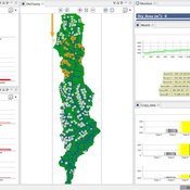
Pedro Phelipe Gonçalves Porto | Published Sunday, April 07, 2019 | Last modified Monday, May 06, 2019This model is a tool to support water management on Samambaia Basin. On it you can explore different scenarios of policy, management and externalities that could influence the water uses. (Scenarios already tested include less rain and payment on water use)
Modeling the decline of labor-sharing in highly variable environments
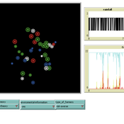
Marco Janssen Andres Baeza-Castro | Published Tuesday, April 02, 2019The rapid environmental changes currently underway in many dry regions of the world, and the deep uncertainty about their consequences, underscore a critical challenge for sustainability: how to maintain cooperation that ensures the provision of natural resources when the benefits of cooperating are variable, sometimes uncertain, and often limited. We present an agent-based model that simulates the economic decisions of households to engage, or not, in labor-sharing agreements under different scenarios of water supply, water variability, and socio-environmental risk. We formulate the model to investigate the consequences of environmental variability on the fate of labor-sharing agreements between farmers. The economic decisions were implemented in the framework of prospect theory.
Peer reviewed From Individual Fuzzy Cognitive Maps to Agent Based Models: Modeling Multi-Factorial and Multi-stakeholder Decision-Making for Water Scarcity
Sara Mehryar | Published Monday, March 04, 2019 | Last modified Wednesday, August 28, 2019This model simulates different farmers’ decisions and actions to adapt to the water scarce situation. This simulation helps to investigate how farmers’ strategies may impact macro-behavior of the social-ecological system i.e. overall groundwater use change and emigration of farmers. The environmental variables’ behavior and behavioral rules of stakeholders are captured with Fuzzy Cognitive Map (FCM) that is developed with both qualitative and quantitative data, i.e. stakeholders’ knowledge and empirical data from studies. This model have been used to compare the impact of different water scarcity policies on overall groundwater use in a farming community facing water scarcity.
MEGADAPT - Socio-hydrological risk model - Theoretical (no data) implementation
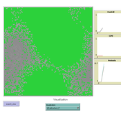
Marco Janssen Andres Baeza-Castro Luis Bojorquez Hallie Eakin | Published Wednesday, February 06, 2019The model simulates the decisions of residents and a water authority to respond to socio-hydrological hazards. Residents from neighborhoods are located in a landscape with topographic complexity and two problems: water scarcity in the peripheral neighborhoods at high altitude and high risk of flooding in the lowlands, at the core of the city. The role of the water authority is to decide where investments in infrastructure should be allocated to reduce the risk to water scarcity and flooding events in the city, and these decisions are made via a multi-objective site selection procedure. This procedure accounts for the interdependencies and feedback between the urban landscape and a policy scenario that defines the importance, or priorities, that the authority places on four criteria.
Neighborhoods respond to the water authority decisions by protesting against the lack of investment and the level of exposure to water scarcity and flooding. Protests thus simulate a form of feedback between local-level outcomes (flooding and water scarcity) and higher-level decision-making. Neighborhoods at high altitude are more likely to be exposed to water scarcity and lack infrastructure, whereas neighborhoods in the lowlands tend to suffer from recurrent flooding. The frequency of flooding is also a function of spatially uniform rainfall events. Likewise, neighborhoods at the periphery of the urban landscape lack infrastructure and suffer from chronic risk of water scarcity.
The model simulates the coupling between the decision-making processes of institutional actors, socio-political processes and infrastructure-related hazards. In the documentation, we describe details of the implementation in NetLogo, the description of the procedures, scheduling, and the initial conditions of the landscape and the neighborhoods.
This work was supported by the National Science Foundation under Grant No. 1414052, CNH: The Dynamics of Multi-Scalar Adaptation in Megacities (PI Hallie Eakin).
CPNorm
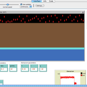
Ruth Meyer | Published Sunday, June 04, 2017 | Last modified Tuesday, June 13, 2017CPNorm is a model of a community of harvesters using a common pool resource where adhering to the optimal extraction level has become a social norm. The model can be used to explore the robustness of norm-driven cooperation in the commons.
05 CmLab V1.17 – Conservation of Money Laboratory
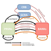
Garvin Boyle | Published Saturday, April 15, 2017In CmLab we explore the implications of the phenomenon of Conservation of Money in a modern economy. This is one of a series of models exploring the dynamics of sustainable economics – PSoup, ModEco, EiLab, OamLab, MppLab, TpLab, CmLab.
Displaying 10 of 49 results water clear search