Our mission is to help computational modelers develop, document, and share their computational models in accordance with community standards and good open science and software engineering practices. Model authors can publish their model source code in the Computational Model Library with narrative documentation as well as metadata that supports open science and emerging norms that facilitate software citation, computational reproducibility / frictionless reuse, and interoperability. Model authors can also request private peer review of their computational models. Models that pass peer review receive a DOI once published.
All users of models published in the library must cite model authors when they use and benefit from their code.
Please check out our model publishing tutorial and feel free to contact us if you have any questions or concerns about publishing your model(s) in the Computational Model Library.
Displaying 10 of 246 results for "G M Leighton" clear search

BESTMAP-ABM-DE is an agent-based model to determine the adoption and spatial allocation of selected agri-environmental schemes (AES) by individual farmers in the Mulde River Basin located in Western Saxony, Germany. The selected AES are buffer areas, cover crops, maintaining permanent grassland and conversion of arable land to permanent grassland. While the first three schemes have already been offered in the case study area, the latter scheme is a hypothetical scheme designed to test the impact of potential policy changes. For the first model analyses, only the currently offered schemes are considered. With the model, the effect of different scenarios of policy design on patterns of adoption can be investigated. In particular, the model can be used to study the social-ecological consequences of agricultural policies at different spatial and temporal scales and, in combination with biophysical models, test the ecological implications of different designs of the EU’s Common Agricultural Policy. The model was developed in the BESTMAP project.
Anchored logistic agent-based model of cooperation among fourteen European Union member states, with structural diagnostics
Alessandro Brugnoletti | Published Friday, October 02, 2026An agent-based model in which fourteen European Union member states each carry a cooperation
propensity in [0,1], updated by a logistic link applied to a latent index that combines the unit’s
own previous state, a weighted average of the other units’ states, and four min-max normalised
exogenous indicators (cooperative benefit, opportunistic temptation, systemic exit cost,
intertemporal confidence). The logistic centres are anchored so that the observed 2024
configuration is an exact fixed point of the baseline map, the device that makes such models
…
Do microfinance institutes help slum-dwellers in coping with frequent disasters? An Agent-Based Modelling study
Mitali Yeshwant Yeshwant Joshi | Published Friday, March 13, 2020The model aims to investigate the role of Microfinance Institutes (MFIs) in strengthening the coping capacity of slum-dwellers (residents) in case of frequent disasters. The main purpose of the model is system understanding. It aids in understanding the following research question: Are the microcredits provided by MFI to start a small business helpful in increasing coping capacity of a slum dweller for recovering from frequent and intense disasters?
User Guide and Templates for RAT-RS (a reporting standard for improving the documentation of data use in agent-based modelling)
Peer-Olaf Siebers Sebastian Achter Melania Borit Edmund Chattoe-Brown | Published Saturday, March 12, 2022The Rigor and Transparency Reporting Standard (RAT-RS) is a tool to improve the documentation of data use in Agent-Based Modelling. Following the development of reporting standards for models themselves, attention to empirical models has now reached a stage where these standards need to take equally effective account of data use (which until now has tended to be an afterthought to model description). It is particularly important that a standard should allow the reporting of the different uses to which data may be put (specification, calibration and validation), but also that it should be compatible with the integration of different kinds of data (for example statistical, qualitative, ethnographic and experimental) sometimes known as mixed methods research.
For the full details on the RAT-RS, please refer to the related publication “RAT-RS: A Reporting Standard for Improving the Documentation of Data Use in Agent-Based Modelling” (http://dx.doi.org/10.1080/13645579.2022.2049511).
Here we provide supplementary material for this article, consisting of a RAT-RS user guide and RAT-RS templates.
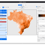
LogoClim: WorldClim in NetLogo
Daniel Vartanian Leandro Garcia Aline Aline Martins de Carvalho | Published Thursday, July 03, 2025 | Last modified Monday, July 13, 2026LogoClim is a NetLogo model designed to be integrated into other simulations through the LevelSpace extension (Hjorth et al., 2020), providing high resolution climate data from sources validated and used by the Intergovernmental Panel on Climate Change (IPCC).
The model simplifies and standardizes the integration of climate data into NetLogo, allowing researchers to focus their efforts on the model itself with the assurance of using reliable and widely recognized data. Although its main use is as a component of larger simulations, LogoClim also has its own graphical interface for monitoring and checking the datasets.
The climate data comes from the WorldClim 2.1 project (Fick & Hijmans, 2017), for which LogoClim works as an interface to NetLogo. The model supports all three WorldClim data series: (1) Historical Climate Data (1970 to 2000), with 12 monthly points for minimum, mean, and maximum temperature, precipitation, solar radiation, wind speed, vapor pressure, elevation, and bioclimatic variables; (2) Historical Monthly Weather Data (1951 to 2024), based on downscaling of CRU-TS-4.09, developed by the Climatic Research Unit at the University of East Anglia (Harris et al., 2020), with minimum and maximum temperature and total precipitation; and (3) Future Climate Data, based on downscaling climate projections derived from global climate models of the Coupled Model Intercomparison Project Phase 6 (CMIP6) (Eyring et al., 2016) for four future periods (2021 to 2040, 2041 to 2060, 2061 to 2080, and 2081 to 2100) and four scenarios based on the Shared Socioeconomic Pathways (SSPs 126, 245, 370, and 585), covering minimum and maximum temperature, total precipitation, and bioclimatic variables. All series are available at multiple spatial resolutions, from 10 minutes (about 340 km² at the equator) to 30 seconds (about 1 km² at the equator).
…
Modeling information Asymmetries in Tourism
Rodolfo Baggio Jacopo A. Baggio | Published Monday, January 09, 2012 | Last modified Saturday, April 27, 2013A very simple model elaborated to explore what may happens when buyers (travelers) have more information than sellers (tourist destinations)
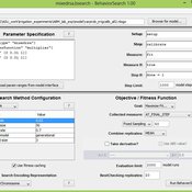
Comparing agent-based models on experimental data of irrigation games
Jacopo A. Baggio Marco Janssen | Published Tuesday, July 02, 2013 | Last modified Wednesday, July 03, 2013Comparing 7 alternative models of human behavior and assess their performance on a high resolution dataset based on individual behavior performance in laboratory experiments.
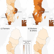
Communication and social change in space and time
Sebastian Kluesener Francesco Scalone Martin Dribe | Published Tuesday, May 17, 2016 | Last modified Friday, October 13, 2017This agent-based model simulates the diffusion of a social change process stratified by social class in space and time which is solely driven social and spatial variation in communication links.
Peer reviewed Infectious diseases model for mixed-methods research chapter
Daniel C Peart Chelsea E Hunter Ian M Hamilton Mark Moritz | Published Sunday, January 30, 2022The purpose of this curricular model is to teach students the basics of modeling complex systems using agent-based modeling. It is a simple SIR model that simulates how a disease spreads through a population as its members change from susceptible to infected to recovered and then back to susceptible. The dynamics of the model are such that there are multiple emergent outcomes depending on the parameter settings, initial conditions, and chance.
The curricular model can be used with the chapter Agent-Based Modeling in Mixed Methods Research (Moritz et al. 2022) in the Handbook of Teaching Qualitative & Mixed Methods (Ruth et al. 2022).
The instructional videos can be accessed on YouTube: Video 1 (https://youtu.be/32_JIfBodWs); Video 2 (https://youtu.be/0PK_zVKNcp8); and Video 3 (https://youtu.be/0bT0_mYSAJ8).
Peer reviewed Routes & Rumours 0.1.1
Martin Hinsch Jakub Bijak Oliver Reinhardt | Published Tuesday, July 12, 2022Routes & Rumours is an agent-based model of (forced) human migration. We model the formation of migration routes under the assumption that migrants have limited geographical knowledge concerning the transit area and rely to a large degree on information obtained from other migrants.
Displaying 10 of 246 results for "G M Leighton" clear search