About the CoMSES Model Library more info
Our mission is to help computational modelers develop, document, and share their computational models in accordance with community standards and good open science and software engineering practices. Model authors can publish their model source code in the Computational Model Library with narrative documentation as well as metadata that supports open science and emerging norms that facilitate software citation, computational reproducibility / frictionless reuse, and interoperability. Model authors can also request private peer review of their computational models. Models that pass peer review receive a DOI once published.
All users of models published in the library must cite model authors when they use and benefit from their code.
Please check out our model publishing tutorial and feel free to contact us if you have any questions or concerns about publishing your model(s) in the Computational Model Library.
We also maintain a curated database of over 7500 publications of agent-based and individual based models with detailed metadata on availability of code and bibliometric information on the landscape of ABM/IBM publications that we welcome you to explore.
Displaying 10 of 212 results Data clear search
NetLogo HIV spread model
Wouter Vermeer | Published Friday, October 25, 2019This model describes the tranmission of HIV by means of unprotected anal intercourse in a population of men-who-have-sex-with-men.
The model is parameterized based on field data from a cohort study conducted in Atlanta Georgia.
Peer reviewed An extended replication of Abelson's and Bernstein's community referendum simulation
Klaus G. Troitzsch | Published Friday, October 25, 2019 | Last modified Friday, August 25, 2023This is an extended replication of Abelson’s and Bernstein’s early computer simulation model of community referendum controversies which was originally published in 1963 and often cited, but seldom analysed in detail. This replication is in NetLogo 6.3.0, accompanied with an ODD+D protocol and class and sequence diagrams.
This replication replaces the original scales for attitude position and interest in the referendum issue which were distributed between 0 and 1 with values that are initialised according to a normal distribution with mean 0 and variance 1 to make simulation results easier compatible with scales derived from empirical data collected in surveys such as the European Value Study which often are derived via factor analysis or principal component analysis from the answers to sets of questions.
Another difference is that this model is not only run for Abelson’s and Bernstein’s ten week referendum campaign but for an arbitrary time in order that one can find out whether the distributions of attitude position and interest in the (still one-dimensional) issue stabilise in the long run.
An agent-based model to simulate meat consumption behaviour of consumers in Britain
Andrea Scalco | Published Friday, October 18, 2019The current rate of production and consumption of meat poses a problem both to peoples’ health and to the environment. This work aims to develop a simulation of peoples’ meat consumption behaviour in Britain using agent-based modelling. The agents represent individual consumers. The key variables that characterise agents include sex, age, monthly income, perception of the living cost, and concerns about the impact of meat on the environment, health, and animal welfare. A process of peer influence is modelled with respect to the agents’ concerns. Influence spreads across two eating networks (i.e. co-workers and household members) depending on the time of day, day of the week, and agents’ employment status. Data from a representative sample of British consumers is used to empirically ground the model. Different experiments are run simulating interventions of application of social marketing campaigns and a rise in price of meat. The main outcome is the average weekly consumption of meat per consumer. A secondary outcome is the likelihood of eating meat.
07 EffLab_V5.07 NL
Garvin Boyle | Published Monday, October 07, 2019EffLab was built to support the study of the efficiency of agents in an evolving complex adaptive system. In particular:
- There is a definition of efficiency used in ecology, and an analogous definition widely used in business. In ecological studies it is called EROEI (energy returned on energy invested), or, more briefly, EROI (pronounced E-Roy). In business it is called ROI (dollars returned on dollars invested).
- In addition, there is the more well-known definition of efficiency first described by Sadi Carnot, and widely used by engineers. It is usually represented by the Greek letter ‘h’ (pronounced as ETA). These two measures of efficiency bear a peculiar relationship to each other: EROI = 1 / ( 1 - ETA )
In EffLab, blind seekers wander through a forest looking for energy-rich food. In this multi-generational world, they live and reproduce, or die, depending on whether they can find food more effectively than their contemporaries. Data is collected to measure their efficiency as they evolve more effective search patterns.
…
An Individual-Based Mechanistic Model of Mussel Bed Boundary Formation and Intensity
Matthew Schumm | Published Saturday, September 28, 2019Individually parameterized mussels (Mytilus californianus) recruit, grow, move and die in a 3D environment while facing predation (in the form of seastar agents), heat and desiccation with increased tide height, and storms. Parameterized with data collected by Wootton, Paine, Kandur, Donahue, Robles and others. See my 2019 CoMSES video presentation to learn more.
Crowdworking Model
Georg Jäger | Published Wednesday, September 25, 2019The purpose of this agent-based model is to compare different variants of crowdworking in a general way, so that the obtained results are independent of specific details of the crowdworking platform. It features many adjustable parameters that can be used to calibrate the model to empirical data, but also when not calibrated it yields essential results about crowdworking in general.
Agents compete for contracts on a virtual crowdworking platform. Each agent is defined by various properties like qualification and income expectation. Agents that are unable to turn a profit have a chance to quit the crowdworking platform and new crowdworkers can replace them. Thus the model has features of an evolutionary process, filtering out the ill suited agents, and generating a realistic distribution of agents from an initially random one. To simulate a stable system, the amount of contracts issued per day can be set constant, as well as the number of crowdworkers. If one is interested in a dynamically changing platform, the simulation can also be initialized in a way that increases or decreases the number of crowdworkers or number of contracts over time. Thus, a large variety of scenarios can be investigated.
Homophily as a process generating social networks: insights from Social Distance Attachment model
Szymon Talaga Andrzej Nowak | Published Tuesday, September 17, 2019This is code repository for the paper “Homophily as a process generating social networks: insights from Social Distance Attachment model”.
It provides all information, code and data necessary to replicate all the simulations and analyses presented in the paper.
This document contains the overall instruction as well as description of the content of the repository.
Details regarding particular stages are documented within source files as comments.
Demography, Industry and Residential Choice (DIReC) model
Jiaqi Ge | Published Wednesday, September 04, 2019The integrated and spatially-explicit ABM, called DIReC (Demography, Industry and Residential Choice), has been developed for Aberdeen City and the surrounding Aberdeenshire (Ge, Polhill, Craig, & Liu, 2018). The model includes demographic (individual and household) models, housing infrastructure and occupancy, neighbourhood quality and evolution, employment and labour market, business relocation, industrial structure, income distribution and macroeconomic indicators. DIReC includes a detailed spatial housing model, basing preference models on house attributes and multi-dimensional neighbourhood qualities (education, crime, employment etc.).
The dynamic ABM simulates the interactions between individuals, households, the labour market, businesses and services, neighbourhoods and economic structures. It is empirically grounded using multiple data sources, such as income and gender-age distribution across industries, neighbourhood attributes, business locations, and housing transactions. It has been used to study the impact of economic shocks and structural changes, such as the crash of oil price in 2014 (the Aberdeen economy heavily relies on the gas and oil sector) and the city’s transition from resource-based to a green economy (Ge, Polhill, Craig, & Liu, 2018).
Roman Amphora reuse
Tom Brughmans | Published Wednesday, August 07, 2019 | Last modified Wednesday, March 15, 2023UPDATE in V1.1.0: missing input data files added; relative paths to input data files changed to “../data/FILENAME”
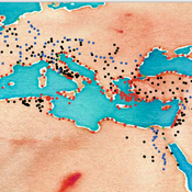
A model that allows for representing key theories of Roman amphora reuse, to explore the differences in the distribution of amphorae, re-used amphorae and their contents.
This model generates simulated distributions of prime-use amphorae, primeuse contents (e.g. olive oil) and reused amphorae. These simulated distributions will differ between experiments depending on the experiment’s variable settings representing the tested theory: variations in the probability of reuse, the supply volume, the probability of reuse at ports. What we are interested in teasing out is what the effect is of each theory on the simulated amphora distributions.
…
An Agent-Based Model of Language Contact
Marco Civico | Published Tuesday, July 30, 2019This model is part of an article that discusses the adoption of a complexity theory approach to study the dynamics of language contact within multilingual communities. The model simulates the dynamics of communication within a community where a minority and a majority group coexist. The individual choice of language for communication is based on a number of simple rules derived from a review of the main literature on the topic of language contact. These rules are then combined with different variables, such as the rate of exogamy of the minority group and the presence of relevant education policies, to estimate the trends of assimilation of the minority group into the majority one. The model is validated using actually observed data from the case of Romansh speakers in the canton of Grisons, Switzerland.
Displaying 10 of 212 results Data clear search


