Our mission is to help computational modelers develop, document, and share their computational models in accordance with community standards and good open science and software engineering practices. Model authors can publish their model source code in the Computational Model Library with narrative documentation as well as metadata that supports open science and emerging norms that facilitate software citation, computational reproducibility / frictionless reuse, and interoperability. Model authors can also request private peer review of their computational models. Models that pass peer review receive a DOI once published.
All users of models published in the library must cite model authors when they use and benefit from their code.
Please check out our model publishing tutorial and feel free to contact us if you have any questions or concerns about publishing your model(s) in the Computational Model Library.
Displaying 9 of 9 results tracking clear search
Peer reviewed MicroAnts 2.5
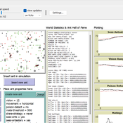
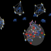
Diogo Alves | Published Thursday, October 16, 2025MicroAnts 2.5 is a general-purpose agent-based model designed as a flexible workhorse for simulating ecological and evolutionary dynamics in artificial populations, as well as, potentially, the emergence of political institutions and economic regimes. It builds on and extends Stephen Wright’s original MicroAnts 2.0 by introducing configurable predators, inequality tracking, and other options.
Ant agents are of two tyes/casts and controlled by 16-bit chromosomes encoding traits such as vision, movement, mating thresholds, sensing, and combat strength. Predators (anteaters) operate in static, random, or targeted predatory modes. Ants reproduce, mutate, cooperate, fight, and die based on their traits and interactions. Environmental pressures (poison and predators) and social dynamics (sharing, mating, combat) drive emergent behavior across red and black ant populations.
The model supports insertion of custom agents at runtime, configurable mutation/inversion rates, and exports detailed statistics, including inequality metrics (e.g., Gini coefficients), trait frequencies, predator kills, and lineage data. Intended for rapid testing and educational experimentation, MicroAnts 2.5 serves as a modular base for more complex ecological and social simulations.
Sandy Beach Visitor Flow: An Agent-Based Model
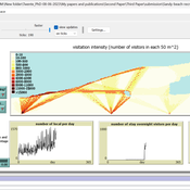
Elham Bakhshianlamouki | Published Thursday, March 14, 2024The model is intended to simulate visitor spatial and temporal dynamics, encompassing their numbers, activities, and distribution along a coastline influenced by beach landscape design. Our primary focus is understanding how the spatial distribution of services and recreational facilities (e.g., beach width, entrance location, recreational facilities, parking availability) impacts visitation density. Our focus is not on tracking the precise visitation density but rather on estimating the areas most affected by visitor activity. This comprehension allows for assessing the diverse influences of beach layouts on spatial visitor density and, consequently, on the landscape’s biophysical characteristics (e.g., vegetation, fauna, and sediment features).
Myside Bias and Group Discussion
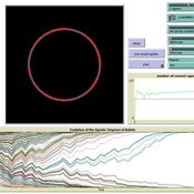
Edoardo Baccini | Published Monday, November 14, 2022 | Last modified Tuesday, September 05, 2023The my-side bias is a well-documented cognitive bias in the evaluation of arguments, in which reasoners in a discussion tend to overvalue arguments that confirm their prior beliefs, while undervaluing arguments that attack their prior beliefs. This agent-based model in Netlogo simulates a group discussion among myside-biased agents, within a Bayesian setting. This model is designed to investigate the effects of the myside bias on the ability of groups to reach a consensus or collectively track the correct answer to a given binary issue.
A Simple Agent Based Modeling Tool for Plastic and Debris Tracking in Oceans
Subu Kandaswamy Koushik Sura Bhaskar Sai Amulya Murukutla Sai Pranay Raju Chinthala Abhishek Bobbillapati | Published Monday, October 04, 2021Plastics and the pollution caused by their waste have always been a menace to both nature and humans. With the continual increase in plastic waste, the contamination due to plastic has stretched to the oceans. Many plastics are being drained into the oceans and rose to accumulate in the oceans. These plastics have seemed to form large patches of debris that keep floating in the oceans over the years. Identification of the plastic debris in the ocean is challenging and it is essential to clean plastic debris from the ocean. We propose a simple tool built using the agent-based modeling framework NetLogo. The tool uses ocean currents data and plastic data both being loaded using GIS (Geographic Information System) to simulate and visualize the movement of floatable plastic and debris in the oceans. The tool can be used to identify the plastic debris that has been piled up in the oceans. The tool can also be used as a teaching aid in classrooms to bring awareness about the impact of plastic pollution. This tool could additionally assist people to realize how a small plastic chunk discarded can end up as large debris drifting in the oceans. The same tool might help us narrow down the search area while looking out for missing cargo and wreckage parts of ships or flights. Though the tool does not pinpoint the location, it might help in reducing the search area and might be a rudimentary alternative for more computationally expensive models.
Epidemic Simulation with Transportation Simulation
FG Econophysics FG Econophysics | Published Monday, March 01, 2021The Episim framework builds upon the established transportation simulation MATSim and is capable of tracking agents’ movements within a network and thus computing infection chains. Several characteristics of the virus and the environment can be parametred, whilst the infection dynamics is computed based upon a compartment model. The spread of the virus can be mitigated by restricting the agents’ activity in certain places.
Introduction of a contact tracking app for outbreak control
Tim Verwaart | Published Tuesday, April 21, 2020The application of a smartphone application to register physical encounters between individuals is considered by public health authorities, as a means to reduce the number of infections in the 2020 COVID-19 pandemic. The general idea is that continuous registration of all other smartphones in the vicinity of an individual’s smartphone potentially enables early warning of the owners of the other smartphones, in case the individual is tested positive as infected. Those other individuals can then go into isolation and be considered for testing. The purpose of the present simulation is to explore the potential effects of this application on frequencies of infection, isolation, and positive and negative infection test results.
Agent-based model of WiFi tracking system in urban environment
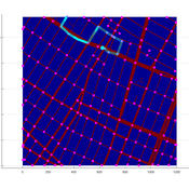
Christopher Thron Khoi Tran | Published Friday, April 21, 2017This code simulates the WiFi user tracking system described in: Thron et al., “Design and Simulation of Sensor Networks for Tracking Wifi Users in Outdoor Urban Environments”. Testbenches used to create the figures in the paper are included.
SimDrink: An agent-based NetLogo model of young, heavy drinkers for conducting alcohol policy experiments
Nick Scott James Wilson Michael Livingston Aaron Hart David Moore Paul Dietze | Published Friday, September 25, 2015 | Last modified Thursday, October 15, 2015A proof-of-concept agent-based model ‘SimDrink’, which simulates a population of 18-25 year old heavy alcohol drinkers on a night out in Melbourne to provide a means for conducting policy experiments to inform policy decisions.
The various technologies used inside a Dutch greenhouse interact in combination with an external climate, resulting in an emergent internal climate, which contributes to the final productivity of the greenhouse. This model examines how differing technology development styles affects the overall ability of a community of growers to approach the theoretical maximum yield.