Our mission is to help computational modelers develop, document, and share their computational models in accordance with community standards and good open science and software engineering practices. Model authors can publish their model source code in the Computational Model Library with narrative documentation as well as metadata that supports open science and emerging norms that facilitate software citation, computational reproducibility / frictionless reuse, and interoperability. Model authors can also request private peer review of their computational models. Models that pass peer review receive a DOI once published.
All users of models published in the library must cite model authors when they use and benefit from their code.
Please check out our model publishing tutorial and feel free to contact us if you have any questions or concerns about publishing your model(s) in the Computational Model Library.
Displaying 10 of 1188 results for "A Flache" clear search
One of four extensions to the standard Adder model that replicates the various interventions typically associated with transition experiments.
The fourth and final extension to the standard Adder model to replicate the various interventions typically associated with Transition Experiments.
Bicycle model
Gudrun Wallentin Dana Kaziyeva Martin Loidl | Published Thursday, January 10, 2019 | Last modified Monday, February 22, 2021The purpose of the model is to generate the spatio-temporal distribution of bicycle traffic flows at a regional scale level. Disaggregated results are computed for each network segment with the minute time step. The human decision-making is governed by probabilistic rules derived from the mobility survey.
Agent-based Simulation Models of the College Sorting Process
Rachel Baker Sean F Reardon Matt Kasman Daniel Klasik | Published Friday, May 23, 2014We explore how dynamic processes related to socioeconomic inequality operate to sort students into, and create stratification among, colleges.
Emergence of Small-World Networks in an Overlapping-Generations Model of Social Dynamics, Trust and Economic Performance
Bogumił Kamiński Jakub Growiec Katarzyna Growiec | Published Thursday, February 27, 2020We study the impact of endogenous creation and destruction of social ties in an artificial society on aggregate outcomes such as generalized trust, willingness to cooperate, social utility and economic performance. To this end we put forward a computational multi-agent model where agents of overlapping generations interact in a dynamically evolving social network. In the model, four distinct dimensions of individuals’ social capital: degree, centrality, heterophilous and homophilous interactions, determine their generalized trust and willingness to cooperate, altogether helping them achieve certain levels of social utility (i.e., utility from social contacts) and economic performance. We find that the stationary state of the simulated social network exhibits realistic small-world topology. We also observe that societies whose social networks are relatively frequently reconfigured, display relatively higher generalized trust, willingness to cooperate, and economic performance – at the cost of lower social utility. Similar outcomes are found for societies where social tie dissolution is relatively weakly linked to family closeness.
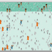
Peer reviewed The OctoPINTS Model: Compliance and periodic fisheries closures (Beta)
Emilie Lindkvist Maja Schlüter Tim M Daw Elizabeth Drury O'Neill Benedetta Veneroni Jineth Berrío-Martínez | Published Wednesday, April 20, 2022The purpose of the model is to explore how processes associated with compliance across different fishery actors’ social groups interplay with their acceptance of a fishery intervention, herein periodic closures of a small-scale octopus fishery. The model agents, entities and processes are designed based on stylized facts from literature and expert workshops on periodic closures in the Western Indian Ocean region, as well as fieldwork from Zanzibari villages that have implemented periodic octopus closures. The model is designed for scientists and decision-makers that are interested in understanding the complex interplay between fishers from different social groups, herein foot fisher men, foot fisher women and male skin divers or free divers within the periodic closure of an octopus species. Including various actions resulting from the restrictions, that is - opportunities that may be presented from restricting fishing in certain areas and during certain times. We are soon publishing an updated model with individual octopuses and their movement behaviors.
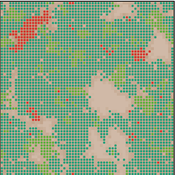
The conditional defector strategy can violate the most crucial supporting mechanisms of cooperation.
Ahmed Ibrahim | Published Tuesday, June 07, 2022 | Last modified Sunday, September 28, 2025Cooperation is essential for all domains of life. Yet, ironically, it is intrinsically vulnerable to exploitation by cheats. Hence, an explanatory necessity spurs many evolutionary biologists to search for mechanisms that could support cooperation. In general, cooperation can emerge and be maintained when cooperators are sufficiently interacting with themselves. This communication provides a kind of assortment and reciprocity. The most crucial and common mechanisms to achieve that task are kin selection, spatial structure, and enforcement (punishment). Here, we used agent-based simulation models to investigate these pivotal mechanisms against conditional defector strategies. We concluded that the latter could easily violate the former and take over the population. This surprising outcome may urge us to rethink the evolution of cooperation, as it illustrates that maintaining cooperation may be more difficult than previously thought. Moreover, empirical applications may support these theoretical findings, such as invading the cooperator population of pathogens by genetically engineered conditional defectors, which could be a potential therapy for many incurable diseases.
Agent-Based Modeling of C. Difficile Spread in Hospitals: Assessing Contribution of High-Touch vs. Low-Touch Surfaces and Inoculations’ Containment Impact
Sina Abdidizaji | Published Monday, January 22, 2024Clostridioides Difficile Infection (CDI) stands out as a critical healthcare-associated infection with global implications. Effectively understanding the mechanisms of infection dissemination within healthcare units and hospitals is imperative to implement targeted containment measures. In this study, we address the limitations of prior research by Sulyok et al., where they delineated two distinct categories of surfaces as high-touch and low-touch fomites, and subsequently evaluated the viral spread contribution of each surface utilizing mathematical modeling and Ordinary Differential Equations (ODE). Acknowledging the indispensable role of spatial features and heterogeneity in the modeling of hospital and healthcare settings, we employ agent-based modeling to capture new insights. By incorporating spatial considerations and heterogeneous patients, we explore the impact of high-touch and low-touch surfaces on contamination transmission between patients. Furthermore, the study encompasses a comprehensive assessment of various cleaning protocols, with differing intervals and detergent cleaning efficacies, in order to identify the most optimal cleaning strategy and the most important factor amidst the array of alternatives.
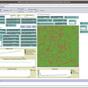
Peer reviewed Mission Cattle
Isaac Ullah | Published Monday, December 15, 2025The model examines cattle herd dynamics on a patchy grassland subject to two exogenous pressures: periodic raiding events that remove animals and scheduled management culling that can target males and/or females. It is intended for comparative experiments on how raiding frequency, culling schedules, vegetation dynamics, and life-history parameters interact to shape herd persistence. The model was specifically designed to test the scenario of cattle herding in the arid grasslands of southern Arizona and northern Sonora during the mission period (late 17th through late 18th centuries, CE). In this period, herds were locally managed by Spanish mission personnel and local O’odham groups. Herds were culled mostly for local consumption of meat, hides, and tallow, but the mission herds were often targets for raiding by neighboring groups. The main purpose of the model is to examine herd dynamics in a seasonally variable, arid environment where herds are subject to both intentional internal harvest (culling) and external harvest (raiding).
Evolution of shedding games
Marco Janssen | Published Sunday, May 16, 2010 | Last modified Saturday, April 27, 2013This simulates the evolution of rules of shedding games based on cultural group selection. A number of groups play shedding games and evaluate the consequences on the average length and the difficulty
Displaying 10 of 1188 results for "A Flache" clear search