About the CoMSES Model Library more info
Our mission is to help computational modelers at all levels engage in the establishment and adoption of community standards and good practices for developing and sharing computational models. Model authors can freely publish their model source code in the Computational Model Library alongside narrative documentation, open science metadata, and other emerging open science norms that facilitate software citation, reproducibility, interoperability, and reuse. Model authors can also request peer review of their computational models to receive a DOI.
All users of models published in the library must cite model authors when they use and benefit from their code.
Please check out our model publishing tutorial and contact us if you have any questions or concerns about publishing your model(s) in the Computational Model Library.
We also maintain a curated database of over 7500 publications of agent-based and individual based models with additional detailed metadata on availability of code and bibliometric information on the landscape of ABM/IBM publications that we welcome you to explore.
Displaying 10 of 45 results for "Daniel Klasik" clear search
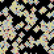
The PARSO_demo Model
Davide Secchi | Published Tuesday, November 05, 2019This model explores different aspects of the formation of urban neighbourhoods where residents believe in values distant from those dominant in society. Or, at least, this is what the Danish government beliefs when they discuss their politics about parallel societies. This simulation is set to understand (a) whether these alternative values areas form and what determines their formation, (b) if they are linked to low or no income residents, and (c) what happens if they disappear from the map. All these three points are part of the Danish government policy. This agent-based model is set to understand the boundaries and effects of this policy.
Agent-based Simulation Models of the College Sorting Process
Rachel Baker Sean F Reardon Matt Kasman Daniel Klasik | Published Friday, May 23, 2014We explore how dynamic processes related to socioeconomic inequality operate to sort students into, and create stratification among, colleges.
Multi-agent model of the spread of climate change denial
Kalina Maria Piskorska Martin Takáč | Published Monday, March 03, 2025This NetLogo model simulates the spread of climate change beliefs within a population of individuals. Each believer has an initial belief level, which changes over time due to interactions with other individuals and exposure to media. The aim of the model is to identify possible methods for reducing climate change denial.
Stoplight parrotfish population model
Tyler Pavlowich | Published Monday, April 02, 2018This agent-based model simulates a stoplight parrotfish population in a heavily-fished Caribbean coral reef. The model allows for the simulation of various fishing regulations and observation of population and catch outcomes. It was built using the structure and equations from several previously published models, including the work of Bozec et al. (2016) and Alonzo and Mangel (2004 and 2005). The initial model conditions are parameterized to population and fishing data collected in Buen Hombre, Dominican Republic by Tyler Pavlowich.
UK Demographic Simulator
Tony Lawson | Published Monday, February 27, 2012 | Last modified Tuesday, October 21, 2014A dynmaic microsimulation model to project the UK population over time
Tyche
Tony Lawson | Published Tuesday, February 28, 2012 | Last modified Saturday, April 27, 2013Demographic microsimulation model used in speed tests against LIAM 2.
The Effectiveness of Image-Scoring Under Different Ecological Conditions
G M Leighton | Published Monday, January 06, 2014The set of models test how receivers ability to accurately rank signalers under various ecological and behavioral contexts.
SiFlo: An Agent-based Model to simulate inhabitants’ behavior during a flood event
Patrick Taillandier Franck Taillandier Pascal Di Maiolo Rasool Mehdizadeh | Published Thursday, July 29, 2021SiFlo is an ABM dedicated to simulate flood events in urban areas. It considers the water flowing and the reaction of the inhabitants. The inhabitants would be able to perform different actions regarding the flood: protection (protect their house, their equipment and furniture…), evacuation (considering traffic model), get and give information (considering imperfect knowledge), etc. A special care was taken to model the inhabitant behavior: the inhabitants should be able to build complex reasoning, to have emotions, to follow or not instructions, to have incomplete knowledge about the flood, to interfere with other inhabitants, to find their way on the road network. The model integrates the closure of roads and the danger a flooded road can represent. Furthermore, it considers the state of the infrastructures and notably protection infrastructures as dyke. Then, it allows to simulate a dyke breaking.
The model intends to be generic and flexible whereas provide a fine geographic description of the case study. In this perspective, the model is able to directly import GIS data to reproduce any territory. The following sections expose the main elements of the model.
ABM Household Decision Making on Solar Energy using Theory of Planned Behaviour
Tatiana Filatova Hannah Muelder | Published Tuesday, May 21, 2019The model aims at estimating household energy consumption and the related greenhouse gas (GHG) emissions reduction based on the behavior of the individual household under different operationalizations of the Theory of Planned Behaviour (TPB).
The original model is developed as a tool to explore households decisions regarding solar panel investments and cumulative consequences of these individual choices (i.e. diffusion of PVs, regional emissions savings, monetary savings). We extend the model to explore a methodological question regarding an interpretation of qualitative concepts from social science theories, specifically Theory of Planned Behaviour in a formal code of quantitative agent-based models (ABMs). We develop 3 versions of the model: one TPB-based ABM designed by the authors and two alternatives inspired by the TPB-ABM of Schwarz and Ernst (2009) and the TPB-ABM of Rai and Robinson (2015). The model is implemented in NetLogo.
Non-attentional visual information transmission in groups under predation
J. Fransje Weerden, van | Published Wednesday, March 25, 2020Our aim is to show effects of group living when only low-level cognition is assumed, such as pattern recognition needed for normal functioning, without assuming individuals have knowledge about others around them or warn them actively.
The model is of a group of vigilant foragers staying within a patch, under attack by a predator. The foragers use attentional scanning for predator detection, and flee after detection. This fleeing action constitutes a visual cue to danger, and can be received non-attentionally by others if it occurs within their limited visual field. The focus of this model is on the effectiveness of this non-attentional visual information reception.
A blind angle obstructing cue reception caused by behaviour can exist in front, morphology causes a blind angle in the back. These limitations are represented by two visual field shapes. The scan for predators is all-around, with distance-dependent detection; reception of flight cues is limited by visual field shape.
Initial parameters for instance: group sizes, movement, vision characteristics for predator detection and for cue reception. Captures (failure), number of times the information reached all individuals at the same time (All-fled, success), and several other effects of the visual settings are recorded.
Displaying 10 of 45 results for "Daniel Klasik" clear search