About the CoMSES Model Library more info
Our mission is to help computational modelers at all levels engage in the establishment and adoption of community standards and good practices for developing and sharing computational models. Model authors can freely publish their model source code in the Computational Model Library alongside narrative documentation, open science metadata, and other emerging open science norms that facilitate software citation, reproducibility, interoperability, and reuse. Model authors can also request peer review of their computational models to receive a DOI.
All users of models published in the library must cite model authors when they use and benefit from their code.
Please check out our model publishing tutorial and contact us if you have any questions or concerns about publishing your model(s) in the Computational Model Library.
We also maintain a curated database of over 7500 publications of agent-based and individual based models with additional detailed metadata on availability of code and bibliometric information on the landscape of ABM/IBM publications that we welcome you to explore.
Displaying 10 of 133 results spatial clear search
Time-averaging and the spatial scale of regional cultural differentiation in archaeological assemblages
Luke Premo | Published Sunday, July 08, 2018We employ this spatially explicit agent-based model to begin to examine how time-averaging can affect the spatial scale of cultural similarity in archaeological assemblage data. The model was built to address this question: to what extent does time-averaging affect the scale of local spatial association in the relative frequency of the most prevalent cultural variant in an archaeological landscape?
Potato late blight model
Francine Pacilly | Published Friday, April 13, 2018The purpose of the model is to simulate the spatial dynamics of potato late blight to analyse whether resistant varieties can be used effectively for sustainable disease control. The model represents an agricultural landscape with potato fields and data of a Dutch agricultural region is used as input for the model. We simulated potato production, disease spread and pathogen evolution during the growing season (April to September) for 36 years. Since late blight development and crop growth is weather dependent, measured weather data is used as model input. A susceptible and late blight resistant potato variety are distinguished. The resistant variety has a potentially lower yield but cannot get infected with the disease. However, during the growing season virulent spores can emerge as a result of mutations during spore production. This new virulent strain is able to infect the resistant fields, resulting in resistance breakdown. The model shows how disease severity, resistance durability and potato yield are affected by the fraction of fields across a landscape with a disease-resistant potato variety.
PolicySpace: agent-based modeling
Francisco Miguel Quesada Bernardo Furtado Isaque Daniel Rocha Eberhardt | Published Tuesday, March 06, 2018PolicySpace models public policies within an empirical, spatial environment using data from 46 metropolitan regions in Brazil. The model contains citizens, markets, residences, municipalities, commuting and a the tax scheme. In the associated publications (book in press and https://arxiv.org/abs/1801.00259) we validate the model and demonstrate an application of the fiscal analysis. Besides providing the basics of the platform, our results indicate the relevance of the rules of taxes transfer for cities’ quality of life.
Agent-based model for the socio-economic monitoring of visitor streams
Stefan Mohr | Published Saturday, January 20, 2018Due to the large extent of the Harz National Park, an accurate measurement of visitor numbers and their spatiotemporal distribution is not feasible. This model demonstrates the possibility to simulate the streams of visitors with ABM methodology.
Cluster Analysis
Lars Spång | Published Sunday, January 14, 2018This model illustrates how to apply a simple cluster-analysis on points distributed around 5 centers. The result can be displayed in shades of a color or a spectacular colored pattern.
cluster analysis
Lars Spång | Published Tuesday, November 07, 2017This model demonstrates how to illustrate a cluster pattern by counting turtles within i moving circle with a specified radius. The procedure is common in archaeological spatial analysis.
Peer reviewed The Effect of Spatial Clustering on Stone Raw Material Procurement
Marco Janssen Simen Oestmo Curtis W Marean | Published Friday, April 21, 2017This model allows for the investigation of the effect spatial clustering of raw material sources has on the outcome of the neutral model of stone raw material procurement by Brantingham (2003).
TERRoir level Organic matter Interactions and Recycling model
Myriam Grillot | Published Wednesday, April 19, 2017 | Last modified Wednesday, June 17, 2020The TERROIR agent-based model was built for the multi-level analysis of biomass and nutrient flows within agro-sylvo-pastoral villages in West Africa. It explicitly takes into account both human organization and spatial extension of such flows.
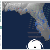
Peer reviewed CHIME ABM Hurricane Evacuation Model
Joshua Watts | Published Friday, March 03, 2017 | Last modified Wednesday, May 29, 2019The CHIME ABM explores information distribution networks and agents’ protective decision making in the context of hurricane landfall.
Increased costs of cooperation help cooperators in the long run
Paul Smaldino | Published Wednesday, March 01, 2017A spatial prisoner’s dilemma model with mobile agents, de-coupled birth-death events, and harsh environments.
Displaying 10 of 133 results spatial clear search