About the CoMSES Model Library more info
Our mission is to help computational modelers at all levels engage in the establishment and adoption of community standards and good practices for developing and sharing computational models. Model authors can freely publish their model source code in the Computational Model Library alongside narrative documentation, open science metadata, and other emerging open science norms that facilitate software citation, reproducibility, interoperability, and reuse. Model authors can also request peer review of their computational models to receive a DOI.
All users of models published in the library must cite model authors when they use and benefit from their code.
Please check out our model publishing tutorial and contact us if you have any questions or concerns about publishing your model(s) in the Computational Model Library.
We also maintain a curated database of over 7500 publications of agent-based and individual based models with additional detailed metadata on availability of code and bibliometric information on the landscape of ABM/IBM publications that we welcome you to explore.
Displaying 10 of 25 results for "Hugo Storm" clear search
Agent-based model of repeated conservation auctions in low-income countries
Sebastian Rasch Elsa Cardona Hugo Storm | Published Sunday, March 22, 2020Our model allows simulating repeated conservation auctions in low-income countries. It is designed to assess policy-making by exploring the extent to which non-targeted repeated auctions can provide biodiversity conservation cost-effectively, while alleviating poverty. Targeting landholders in order to integrate both goals is claimed to be overambitious and underachieving because of the trade-offs they imply. The simulations offer insight on the possible outcomes that can derive from implementing conservation auctions in low-income countries, where landholders are likely to be risk averse and to face uncertainty.
Sea Bright, NJ Reconstruction of Hurricane Sandy
Kim McEligot | Published Saturday, March 20, 2021 This model implements a combined Protective Action Decision Model (PADM) and Protection Motivation Theory (PAM) model for human decision making regarding hazard mitigations. The model is developed and integrated into the MASON modeling framework. The ABM implements a hind-cast of Hurricane Sandy’s damage to Sea Bright, NJ and homeowner post-flood reconstruction decisions. It was validated against FEMA damage assessments and post-storm surveys (O’Neil 2017).
Multi-Hazard Coastal Agent-Based Model (MHCABM)
Andrew Allison | Published Thursday, August 05, 2021MHCABM is an agent-based, multi-hazard risk interaction model with an integrated applied dynamic adaptive pathways planning component. It is designed to explore the impacts of climate change adaptation decisions on the form and function of a coastal human-environment system, using as a case study an idealised patch based representation of the Mount North-Omanu area of Tauranga city, New Zealand. The interacting hazards represented are erosion, inundation, groundwater intrusion driven by intermittent heavy rainfall / inundations (storm) impacts, and sea level rise.
Retail Competition Agent-based Model
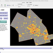
Derek Robinson Jiaxin Zhang | Published Sunday, January 03, 2021 | Last modified Wednesday, November 10, 2021The Retail Competition Agent-based Model (RC-ABM) is designed to simulate the retail competition system in the Region of Waterloo, Ontario, Canada, which which explicitly represents store competition behaviour. Through the RC-ABM, we aim to answer 4 research questions: 1) What is the level of correspondence between market share and revenue acquisition for an agent-based approach compared to a traditional location-allocation-based approach? 2) To what degree can the observed store spatial pattern be reproduced by competition? 3) To what degree are their path dependent patterns of retail success? 4) What is the relationship between retail survival and the endogenous geographic characteristics of stores and consumer expenditures?
Influence with over-confident agents
Juliette Rouchier Emily Tanimura | Published Wednesday, October 21, 2015Agents can influence each other if they are close enough in knowledge. The probability to convince with good knowledge and number of agents have an impact on the dissemination of knowledge.
Coastal Coupled Housing and Land Markets (C-CHALMS)
Nicholas Magliocca | Published Thursday, May 18, 2017Next generation of the CHALMS model applied to a coastal setting to investigate the effects of subjective risk perception and salience decision-making on adaptive behavior by residents.
An Individual-Based Mechanistic Model of Mussel Bed Boundary Formation and Intensity
Matthew Schumm | Published Saturday, September 28, 2019Individually parameterized mussels (Mytilus californianus) recruit, grow, move and die in a 3D environment while facing predation (in the form of seastar agents), heat and desiccation with increased tide height, and storms. Parameterized with data collected by Wootton, Paine, Kandur, Donahue, Robles and others. See my 2019 CoMSES video presentation to learn more.
Climate Change Adaptation in Coastal Regions
Emma Cutler | Published Thursday, June 01, 2017This generic model simulates climate change adaptation in the form of resistance, accommodation, and retreat in coastal regions vulnerable to sea level rise and flooding. It tracks how population changes as households retreat to higher ground.
ManPraSim: A Management Practice Simulation
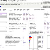
peer-olaf_siebers | Published Wednesday, February 23, 2011 | Last modified Saturday, April 27, 2013This simulation model is associated with the journal paper “A First Approach on Modelling Staff Proactiveness in Retail Simulation Models” to appear in the Journal of Artificial Societies and Social Simulation 14 (2) 2. The authors are Peer-Olaf Siebers ([email protected]) and Uwe Aickelin ([email protected]).
Mobility, Resource Harvesting and Robustness of Social-Ecological Systems
Irene Perez Ibarra | Published Monday, September 24, 2012 | Last modified Saturday, April 27, 2013The model is a stylized representation of a social-ecological system of agents moving and harvesting a renewable resource. The purpose is to analyze how mobility affects sustainability. Experiments changing agents’ mobility, landscape and information governments have can be run.
Displaying 10 of 25 results for "Hugo Storm" clear search

