About the CoMSES Model Library more info
Our mission is to help computational modelers at all levels engage in the establishment and adoption of community standards and good practices for developing and sharing computational models. Model authors can freely publish their model source code in the Computational Model Library alongside narrative documentation, open science metadata, and other emerging open science norms that facilitate software citation, reproducibility, interoperability, and reuse. Model authors can also request peer review of their computational models to receive a DOI.
All users of models published in the library must cite model authors when they use and benefit from their code.
Please check out our model publishing tutorial and contact us if you have any questions or concerns about publishing your model(s) in the Computational Model Library.
We also maintain a curated database of over 7500 publications of agent-based and individual based models with additional detailed metadata on availability of code and bibliometric information on the landscape of ABM/IBM publications that we welcome you to explore.
Displaying 10 of 112 results for "Kenneth B Wilson" clear search
Confirmation Bias improves Performance in a Signal Detection Task and evolves in an Evolutionary Algorithm
Michael Vogrin | Published Monday, May 08, 2023Confirmation Bias is usually seen as a flaw of the human mind. However, in some tasks, it may also increase performance. Here, agents are confronted with a number of binary Signals (A, or B). They have a base detection rate, e.g. 50%, and after they detected one signal, they get biased towards this type of signal. This means, that they observe that kind of signal a bit better, and the other signal a bit worse. This is moderated by a variable called “bias_effect”, e.g. 10%. So an agent who detects A first, gets biased towards A and then improves its chance to detect A-signals by 10%. Thus, this agent detects A-Signals with the probability of 50%+10% = 60% and detects B-Signals with the probability of 50%-10% = 40%.
Given such a framework, agents that have the ability to be biased have better results in most of the scenarios.
Simulating the cost of social care in an ageing population
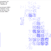
Eric Silverman | Published Thursday, September 16, 2021This model is an agent-based simulation written in Python 2.7, which simulates the cost of social care in an ageing UK population. The simulation incorporates processes of population change which affect the demand for and supply of social care, including health status, partnership formation, fertility and mortality. Fertility and mortality rates are drawn from UK population data, then projected forward to 2050 using the methods developed by Lee and Carter 1992.
The model demonstrates that rising life expectancy combined with lower birthrates leads to growing social care costs across the population. More surprisingly, the model shows that the oft-proposed intervention of raising the retirement age has limited utility; some reductions in costs are attained initially, but these reductions taper off beyond age 70. Subsequent work has enhanced and extended this model by adding more detail to agent behaviours and familial relationships.
The version of the model provided here produces outputs in a format compatible with the GEM-SA uncertainty quantification software by Kennedy and O’Hagan. This allows sensitivity analyses to be performed using Gaussian Process Emulation.
A simple model that aims to demonstrate the influence of agri-environmental payments on land-use patterns in a virtual landscape. The landscape consists of grassland (which can be managed extensively or intensively) and a river. Agri-environmental payments are provided for extensive management of grassland. Additionally, there are boni for (a) extensive grassland in proximity of the river; and (b) clusters (“agglomerations”) of extensive grassland. The farmers, who own randomly distributed grassland patches, make decisions either on the basis of simple income maximization or they maximize only up to an income threshold beyond which they seize making changes in management. The resulting landscape pattern is evaluated by means of three simple models for (a) agricultural yield, (b) habitat/biodiversity and (c) water quality. The latter two correspond to the two boni. The model has been developed within a small project called Aligning Agent-Based Modelling with Multi-Objective Land-Use Allocation (ALABAMA).
MERCURY extension: population
Tom Brughmans | Published Thursday, May 23, 2019This model is an extended version of the original MERCURY model (https://www.comses.net/codebases/4347/releases/1.1.0/ ) . It allows for experiments to be performed in which empirically informed population sizes of sites are included, that allow for the scaling of the number of tableware traders with the population of settlements, and for hypothesised production centres of four tablewares to be used in experiments.
Experiments performed with this population extension and substantive interpretations derived from them are published in:
Hanson, J.W. & T. Brughmans. In press. Settlement scale and economic networks in the Roman Empire, in T. Brughmans & A.I. Wilson (ed.) Simulating Roman Economies. Theories, Methods and Computational Models. Oxford: Oxford University Press.
…
Root disease model
Adam Bouche | Published Sunday, September 30, 2018This is a model of root disease spread between trees in the landscape. The disease spreads via two transmission processes: (a) root contact/root graft transmission between adjacent trees and (b) insect vectors that carry spores between trees. Full details can be found in the “Info” tab in the model and in the readme file in the GitHub repository.
DroneStrikes_TerroristAttacks
B Shapiro | Published Friday, July 15, 2022ABM focused on examining the dissemination of opinions through a notional terrorist network to generate terrorist attacks caused by drone strikes.
Change and Senescence
André Martins | Published Tuesday, November 10, 2020Agers and non-agers agent compete over a spatial landscape. When two agents occupy the same grid, who will survive is decided by a random draw where chances of survival are proportional to fitness. Agents have offspring each time step who are born at a distance b from the parent agent and the offpring inherits their genetic fitness plus a random term. Genetic fitness decreases with time, representing environmental change but effective non-inheritable fitness can increase as animals learn and get bigger.
NarcoLogic
Nicholas Magliocca | Published Thursday, August 29, 2019Investigate spatial adaptive behaviors of narco-trafficking networks in response to various counterdrug interdiction strategies within the cocaine transit zone of Central America and associated maritime areas. Through the novel application of the ‘complex adaptive systems’ paradigm, we implement a potentially transformative coupled agent-based and interdiction optimization modeling approach to compellingly demonstrate: (a) how current efforts to disrupt narco-trafficking networks are in fact making them more widespread, resilient, and economically powerful; (b) the potential for alternative interdiction approaches to weaken and contain traffickers.
The Geography of Conflict Diamonds: The Case of Sierra Leone
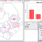
Andrew Crooks Bianica Pires | Published Thursday, March 24, 2016 | Last modified Thursday, March 24, 2016Using Sierra Leone as a test case, the purpose of the model is to explore the role of geography in a resource-driven war. An ABM is integrated with geographic information systems (GIS) for this purpose.
Towards an Agent-Based Model for Civil Revolution: Modeling Emergence of Protesters, Military Decisions, and Resulting State of
Salwa Ismail | Published Friday, August 18, 2017This paper builds on a basic ABM for a revolution and adds a combination of behaviors to its agents such as military benefits, citizen’s grievances, geographic vision, empathy, personality type and media impact.
Displaying 10 of 112 results for "Kenneth B Wilson" clear search

