
This release is out-of-date. The latest version is
1.4.0
Deforestation 1.0.0
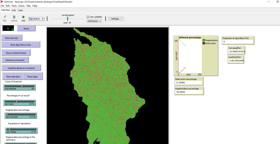
Deforestation Simulation Model in NetLogo with GIS Layers
This model has developed in Netlogo software and utilizes
the GIS extension.
This NetLogo-based agent-based model (ABM) simulates deforestation dynamics using the GIS extension. It incorporates parameters like wood extraction, forest regeneration, agricultural expansion, and livestock impact. The model integrates spatial layers, including forest areas, agriculture zones, rural settlements, elevation, slope, and livestock distribution. Outputs include real-time graphical representations of forest loss, regeneration, and land-use changes. This model helps analyze deforestation patterns and conservation strategies using ABM and GIS.
Release Notes
Add ASC Layers
Add persian Language