MoPAgrIB: simulating savannah landscape mosaic under shifting cultivation 1.1.0
MoPAgrIB is a simulator of savannah landscape mosaic under shifting cultivation.
The study area is Wanté village located at the foot of Poli massif in North Cameroon. The village is composed of sixty households, who are all from the Duupa ethnic community. All of them are farmers.
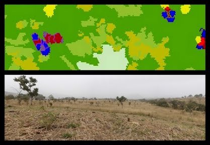
The landscape is mainly characterized by the presence of cultivated patches of 2 to 10 ha, distributed in the savannah with no regular pattern solely attributable to distances from the habitat, land ownership or soil quality.
The aim of MoPAgrIB model is to simulate the evolution of theses cultivated patches, which we called field clusters ; how they move through the landscape, depending on farming practices, population growth, social rules and vegetation growth.
Various scenario have been simulated as for example a scenario that simulates the landscape evolution from 2006 to 30 years beyond and explores the relation between the spatial extent of agriculture and the farmers social position.